.")
Take BART to your next hiking trail
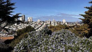
Hiking the Filbert Street Steps to Coit Tower is one of the best urban hikes in the Bay Area. Photo courtesy of SFGATE (Matt Charnock).
The Bay Area is home to world-class hiking. From urban treks and lake loops to vistas and scenic dirt paths, we’re spoiled for choice when it comes to outdoor adventures. To help you find your next trek, we've compiled a list of ten BARTable Bay Area hikes. The best part? Every trailhead is less than a mile from a BART station. Whether you’re into hitting the trails or exploring the city streets, your next hike is just a BART ride away.
Use BART's Trip Planner for detailed routes and transit options.
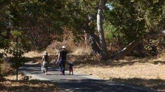
The Penitencia Trail starts at Berryessa/North San Jose. Photo courtesy of Visit San Jose.
Penitencia Creek Trail | Berryessa/North San Jose
From Berryessa/North San Jose, hop on the paved Penitencia Creek Trail and head east toward Alum Rock Park — one of California’s oldest municipal parks. Once a route for railcars shuttling San Jose residents to mineral springs, today the trail offers a peaceful path past historic remnants, shaded picnic areas and kid-friendly playgrounds. The 3.9-mile stretch along the creek to Rock Canyon Circle lets you tailor your hike to your pace, no matter how fast or slow you want to go. If you're looking for a little more adventure, continue deeper into Alum Rock Park or connect to the Bay Area Ridge Trail.
Enjoy hiking trails in Central Park. Photo courtesy of AllTrails.
Central Park | Fremont
Central Park is home to the beautiful Lake Elizabeth. To get a view of the water from all vantage points, hop on the paved 2.36-mile trail that loops around the lake. It's the ideal pathway for a leisurely hike, offering a chance to spot visiting waterfowl. Whether you're up for a solo stroll or a sunny afternoon with the family, this spot checks all the boxes. You'll find Central Park 0.8 miles from Fremont Station. Follow Civic Center Drive to the Fremont Main Library, where the trail begins just behind it.
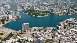
Hiking around Lake Merritt lets you escape city noises and enjoy nature. Photo courtesy of Visit Oakland.
Lake Merritt Loop | Lake Merritt
There’s something peaceful about an urban stroll around Lake Merritt. The 3.2-mile loop is flat, paved and packed with scenery—from birdwatching to Oakland skyline views and waterfront gardens. It’s a great walk for families, joggers, or anyone looking for a relaxing escape without leaving the city. After your Bay Area urban adventure, treat yourself to a meal at one of Oakland’s many fantastic eateries nearby. To get to the lake, exit BART at Lake Merritt. You’ll find the waterfront path 0.3 miles from the station.
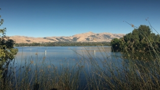
Explore the trails in the Temescal Regional Recreation Area. Photo courtesy of AllTrails.
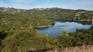
Temescal Regional Recreation Area | Rockridge
From Rockridge, walk north along Broadway to the north entrance of Temescal Regional Recreation Area. There are plenty of hiking trails here. Encircling the lake is an easy walk, framed by native plants, shady trees, and perhaps even a heron or a few ducks. Along the way, you’ll pass fishing piers, picnic areas and a small beach that’s popular during summer.
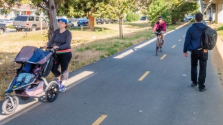
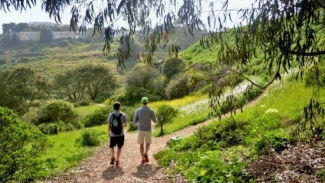
Tackle the full 10.7-mile out-and-back hike or trek from BART to BART. Photo courtesy of Rails to Trails Conservancy.
Ohlone Greenway | North Berkeley
Exit BART at North Berkeley and step right onto the Ohlone Greenway, a multi-use trail that runs from Berkeley through Albany to El Cerrito. This flat, paved 10.7-mile out-and-back path connects a string of parks, gardens, playgrounds and neighborhoods along a former BART rail corridor. Hikers have a couple of options when they reach the end of the trail. Hop on BART at El Cerrito Plaza or El Cerrito Del Norte, or hike back to North Berkeley. The Ohlone Greenway is stroller-friendly and shaded in parts, making it an ideal spot for casual strolls, long bike rides, or weekend wanderings with friends. The scenic urban hike is filled with nature, art, and plenty of places to stop along the way for a coffee.
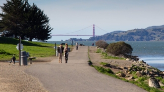
The Point Isabel Regional Shoreline is a scenic hike in the East Bay. Photo courtesy of SF Bay Area Water Trail.
Point Isabel Regional Shoreline | El Cerrito Plaza
The bayside trails at the Point Isabel Regional Shoreline are only 0.9 miles from El Cerrito Plaza. While hitting the trails, you’ll enjoy panoramic views of the Bay, including San Francisco, the Golden Gate Bridge and Mount Tamalpais on clear days. The flat, paved route runs along the water with plenty of benches for taking in the views. Birdwatchers can spot egrets, sandpipers and even hawks cruising overhead. The trail connects to Richmond’s Marina Bay, allowing you to extend your adventure.
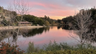
A quick stroll from Lafayette Station and you'll arrive at the gorgeous Lafayette Reservoir. Photo courtesy of EBMUD.
Lafayette Reservoir | Lafayette
You’ll find the entrance to the Lafayette Reservoir just under a mile from Lafayette Station. There are two loop trails here. The first is the Lakeside Nature Trail (paved, 2.7 miles) and the second is the Rim Trail (unpaved, 4.7 miles). When you factor in all the connecting trails, the Lafayette Reservoir offers over 10 miles of scenic hiking. These East Bay hiking trails offer a great adventure for everyone, from experienced hikers to families with young children.
Don't forget to bring water on the moderate East Bay hike. Photo courtesy of AllTrails.
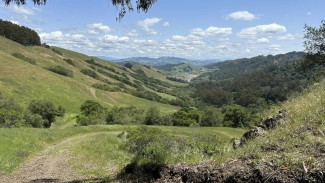
De LaVeaga Trailhead | Orinda
Looking for a challenge? Head to Orinda Station and walk just 0.4 miles to the De LaVeaga Trailhead at Siesta Valley Recreation Area, part of the East Bay Regional Parks system. This 6.7-mile out-and-back trail offers a moderate workout, with a steep initial climb that rewards you with quiet ridgelines, grassy meadows and scenic views of Mt. Diablo and San Pablo Reservoir, at least on a clear day. Keep your eyes peeled for wild turkeys, hawks and the occasional coyote in the distance. Don't worry —the steep climb at the start pays off with a decline on the return.
The gorgeous views are worth the climb on this stunning San Francisco urban hike. Photo courtesy of AllTrails.
Filbert Street Steps | Embarcadero
Start this urban trek at Embarcadero and head to the San Francisco Ferry Building. Stroll along the waterfront and admire the boats bobbing up and down in the Bay until you get to Filbert Street. Turn left and head through Levi's Plaza until you reach the Filbert Street staircase. Head up the steps to climb past wooden cottages and lush greenery lining both sides of the stairs. Continue climbing to Coit Tower where you'll be rewarded with stunning panoramic city views. It's truly spectacular. Here, you have two options. You can come back down the Greenwich Steps or wander through North Beach and Chinatown before looping back to BART.
While hiking in San Francisco's Glen Canyon, you'll feel far from the hustle and bustle of the city. Photo courtesy of San Francisco Recreation and Parks.
Glen Canyon | Glen Canyon
Glen Canyon Park spans 66.6 acres full of dirt paths, dramatic rock formations and steep staircases. Wander along the canyon floor and enjoy the scent of Eucalyptus trees, scale the cliffsides and soak up the forest views. It's a fantastic place for bird watching, and in fact, is one of the few places in San Francisco where you can see red-tailed hawks and great horned owls nesting. One popular route in the area is the 1.8-mile Glen Canyon Park Loop. The park is only 0.4 miles from Glen Park, but as a fun alternative, you can also hike from Glen Park to 16th St Mission.
What's your favorite BARTable hike?
Share with us on social media at @SFBARTable and #SFBARTable! Keep up with us on Instagram and Facebook to see all of the best BARTable events, places to eat and where to have fun around the Bay.