BARTable Walk: Glen Park to 16th Street Mission
When:
On a nice day
Where:
2901 Diamond Street
San Francisco, CA 94131
United States
BART Station:
Glen Park (SF)Walk Time:
3.5-4 hoursThe Glen Park welcome sign. Photo courtesy of Guy Joaquin.
Take a hike! An urban hike, that is, in San Francisco through the site of America’s first dynamite factory, up and over famous Twin Peaks and across the city’s geographical center on this BARTable Walk from the Glen Park neighborhood to the Mission District.
Walk Time: 3.5 – 4 hours | Distance: 6.5 miles | Terrain: Sidewalks, paved & dirt trails
Route Maps
Head down Kern Street between Pebble’s Café and Gialina Pizzeria and veer left onto the Glen Park Greenway. At the end on Elk Street, take a right and cross over to Glen Canyon Park.
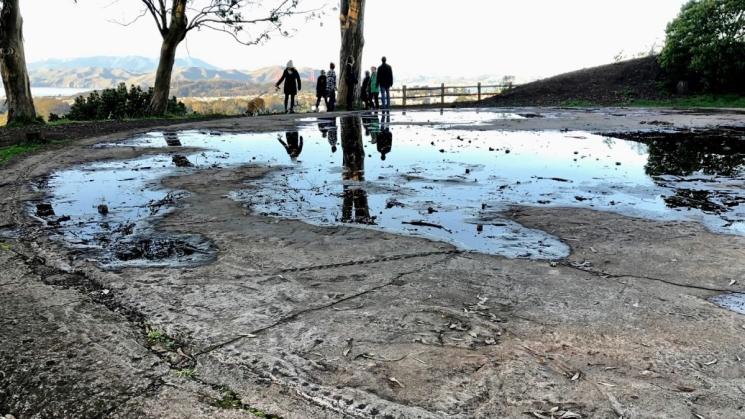
The 66-acre park draws residents and visitors to its playground, sports fields and hiking trails. As with most places in San Francisco, the site has a long and diverse human history that starts with the ancestors of the Yelamu Ramaytush Ohlone tribe who likely hunted and gathered in the canyon for thousands of years. In more recent times, the Giant Powder Company set up a dynamite manufacturing plant here in 1868, the first in the U.S., under an exclusive license from inventor Alfred Nobel. But just the following year, they moved out after a massive explosion leveled the operation and killed several workers. In 1898, real estate development firm Baldwin and Howell opened a “pleasuring grounds” with a small zoo that featured highwire acts across the canyon, sharpshooter performances, hot-air balloon acrobatic shows and other thrilling attractions to lure potential buyers. In the 1960s, residents banded together to stop the construction of the Crosstown Freeway that would have run through the canyon to connect Interstate 280 with the Golden Gate Bridge.
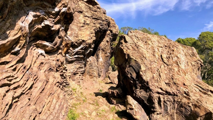 The large rock formations dotted around Glen Canyon Park (some of Franciscan chert) attract and challenge rock climbers to test their bouldering skills. Photo courtesy of Guy Joaquin.
Make your way into the park and at the end of the paved path, head right onto the Gum Tree Girls Trail and follow it across the boardwalks to the Islais Creek Trail. Continue along the winding path and take the zigzag stairs up to Portola Drive. (Follow the trail markers that indicate the direction towards Portola.) Cross to the other side of the street, head left to Twin Peaks Blvd and then take a right to start the climb up to Twin Peaks. The designated path is the direct route to the top with a couple of stairs and street crossings. You can stick to the side of the road for a more gradual, but longer ascent. At the top, take a breather and give yourself a high five for hoofing it all the way under your own steam. If you’re up for some more stairwork, continue up and over the actual two peaks themselves. Otherwise, head right along the pedestrian-only portion of the road.
A few fun facts: At 925 feet, only Mount Davidson (928 feet) is higher than Twin Peaks within the city. Each peak has its own name: The south one is “Noe” and the north is “Eureka.” It was named “Los Pechos de la Chola” (The Breasts of the Maiden) by the early Spanish settlers. It’s not exactly known what the Ohlone may have called it, but tradition holds that it was originally a single peak of a united man and woman and because the two fought so much, the Great Spirit split them into the two peaks with a lightning bolt.
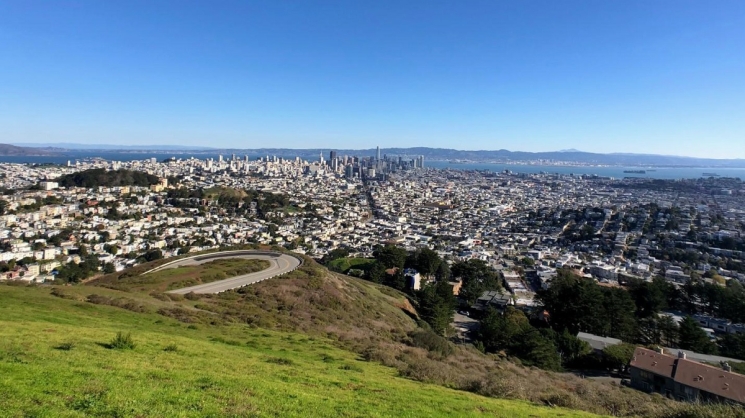 If “Karl the Fog” has the day off, you’ll be rewarded on Twin Peaks with panoramic city and bay views that have made it a must-see for visitors and locals alike. Photo courtesy of Guy Joaquin.
Keep to the right on the pedestrian-only road, pass the Christmas Tree Point vista area as it circles back to Twin Peaks Blvd and take a right to start the walk down. At the switchback in the road, take a look back up to the summit. The slope beneath the vista area is where the giant Pink Triangle is laid out each year to celebrate Pride Weekend. At Clarendon Avenue, cross to the other side and take a right. In about 170 feet, take a left up a wooden staircase to Tank Hill, one of the city’s hidden gems. The park was named for a water tank built by the Spring Valley Water Company in 1894 to store drinking water from the Laguna Honda reservoir. The tank passed to the San Francisco Water Department in 1930 and was removed in 1957. Residents at the time reported seeing goldfish flowing down the street when the tank was drained! The land was saved from being developed for houses when the city purchased it in 1977 and turned it into a park.
 You can still see the circular concrete foundation of the water tank in the middle of Tank Hill. Photo courtesy of Guy Joaquin.
Follow the path to the right around the perimeter of the park. You’ll get some more spectacular views of the city and hopefully come across one or two pop-up rope swings for a thrilling ride, if you dare. At the end of the path, take the stairs down to Belgrave Avenue and veer right onto Shrader Street. Cross to the other side of 17th Street, take a right up and cross again at the intersection with Clayton Street. After about 120 feet, take a left up the concrete Monument Way Stairs. At the top, take another left onto Upper Terrace to another hidden city gem, Mount Olympus, once thought to be the geographical center of the city. Before the houses, apartment buildings and trees popped up here, there was a commanding 360-degree view from the hilltop. In 1887, Adolph Sutro (of Sutro Baths, Cliff House and former mayor fame) capped it with a monumental statue, a gift to San Francisco, called “Triumph of Light.” It depicted the Goddess of Liberty holding a torch in one hand, like the Statue of Liberty, and a sword in the other while towering over a man representing evil and tyranny.
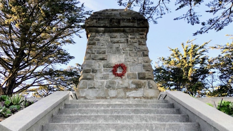 By the late 1950s, the “Triumph of Light” statue on Mount Olympus had fallen to vandalism and disrepair and was removed by the city leaving only its pedestal behind. What happened to it remains a mystery to this day. Photo courtesy of Guy Joaquin.
On the side of the hill facing the bay, take the Mount Olympus Stairs on the left down to the lower section of Upper Terrace and make a left. At the intersection with Masonic Avenue, cross over and veer right onto Roosevelt Way.
From Roosevelt Way, turn right onto Museum Way and follow it down to the Randall Museum. Tucked into the Corona Heights neighborhood and named for Josephine Randall, San Francisco's first superintendent of recreation, the museum focuses on science, nature and the arts on a very approachable scale. In addition to its many exhibits, the Randall offers art, ceramics and woodshop classes and has a live animal section of native California wildlife. You can pick up a refreshment, snack or lunch from the museum’s Café Josephine and enjoy it on the patio outside. (Tuesday to Saturday, 10am to 5pm; Free admission!)
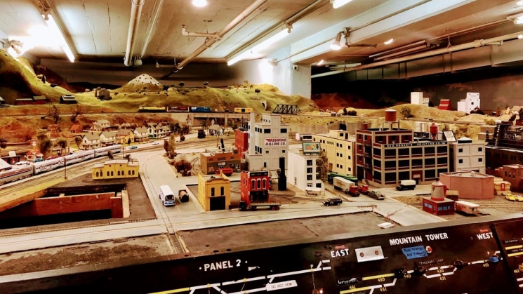 On the basement floor of the Randall Museum is an expansive and automated model train landscape originally constructed by the Golden Gate Model Railroad Club. Photo courtesy of Guy Joaquin.
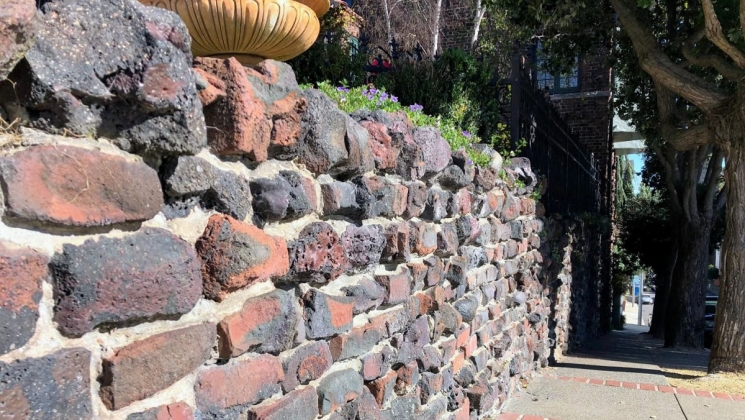
Double back down Museum Way to resume the walk and take a right back onto Roosevelt Way. As you round Corona Heights Park, spot the rock outcrops of chert (hard rock) like those in Glen Canyon. At 15th Street, cross to the left, head up Park Hill Avenue and take a right onto Buena Vista Avenue East. Across the street is Buena Vista Park, the oldest park in the city (established in 1867 as Hill Park). If you have time for a visit, keep an eye out for small white pieces lining a drainage gutter on the west side of the park. They are marble fragments of cemetery headstones! From 1914 through the 1940s, San Francisco removed all cemeteries within city limits (except the National and Mission Dolores Cemeteries) and relocated the headstones to Colma, but not always with the remains! Those unclaimed were broken down and recycled into public works projects, like the seawalls at Aquatic Park and Ocean Beach and the gutter here in the park.
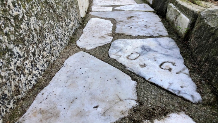 A few of the fragments lining the drainage gutter in Buena Vista Park are sections of the headstone engravings. Photo courtesy of Guy Joaquin.
At the east end of the park, head down Duboce Avenue (watch your step – it’s a steep descent) and pass the Harvey Milk Center for the Arts and Duboce Park. Take a right onto Church Street, cross over Market Street and take a left onto 16th Street. Around the corner at Dolores Street, you’ll find the historic Mission Dolores. Find out more about this oldest standing building in the city on BARTable Walk: 16th Street Mission to Glen Park. Another building with a fascinating history is right across the street. St. Matthew’s Lutheran Church is the only Lutheran church left in Northern California that offers services in German and it was the only church in San Francisco allowed to do so during World War II. Built in 1907, it served the once large German- speaking community of San Francisco that began to grow after the start of the Gold Rush in 1848.
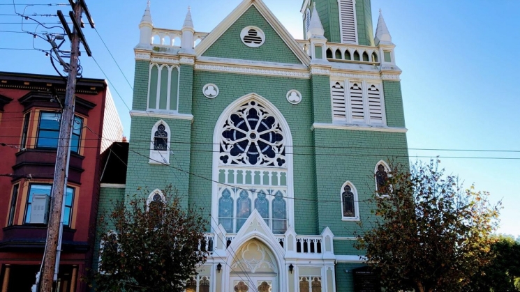 St. Matthew’s Lutheran Church is adorned with ornate stained glass windows, including one above its altar gifted by Helene Strybing who financed the creation of the arboretum and botanical garden in Golden Gate Park. Photo courtesy of Guy Joaquin.
Finish up the walk by continuing down the street to the 16th Street Mission Station.
Variations and options
- Extend the walk: Make it a loop and continue with BARTable Walk: 16th Street Mission to Glen Park.
- Join a walking tour: San Francisco City Guides offers tours of the Corona Heights and Mission Dolores neighborhoods. Free ($15 suggested donation).
- Hang around: Have a wander around bustling Valencia and Mission Streets. Within just a two-block radius of the station alone are dozens of unique shops, bars, cafes and restaurants.
What to bring: Sturdy walking or hiking shoes and a daypack with water, bag lunch or snacks (or pick up along the way), sun protection (hat, sunscreen), extra layers or rain gear (just in case). A smartphone is handy for maps and looking up information or taking photos. And, of course, your Clipper Card or App!
About the stations
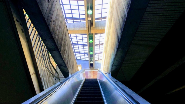
Glen Park Station opened in November of 1973. It is the only station in San Francisco with parking spaces and was co-designed by Bay Area architect Ernest Born with marble floors, murals and natural stone walls. (Born also designed the original BART signage.) The station provides access to the J Church line of the Muni Metro via a pedestrian bridge. Along with the 19th Street/Oakland Station, it was used for a scene in the movie “The Pursuit of Happyness” with Will Smith.
16th Street Mission Station opened in November of 1973 and like its twin, 24th Street Mission, is positioned underground. Both stations feature large concrete reliefs by English sculptor William Mitchell on the entrance walls and multicolored tiles on the concourse and platform levels. The two street-level plazas, renovated during the early 2000s, are regularly used as gathering spaces for public meetings and street performances.
We're social.
What's your favorite part of this walk? Let us know via social media, @SFBARTable #SFBARTable! Keep up with us on Facebook, Instagram and Twitter to see all of the best BARTable events, places to eat and have fun around the Bay.