BARTable Walk: Embarcadero to 24th Street Mission
When:
Enjoy on a nice day
Where:
298 Market St.
San Francisco, CA 94111
United States
BART Station:
Embarcadero (SF)Walk Time:
3 hoursWhere’s the Warriors’ new arena gonna be? What’s the crookedest street in San Francisco? (Spoiler alert! It’s not Lombard.) How did the Dogpatch neighborhood get its name? Get the answers on this BARTable walk along the Embarcadero, through Mission Bay and up and over Potrero Hill to the Mission district.
Walk Time: 3 hours | Distance: 6 miles | Terrain: Sidewalks, dirt trail (one steep hill)
Exit the Embarcadero Station (use Exit A1) to the street level and head east away from downtown to the end of Market Street. Walk through the Embarcadero Plaza and cross over to the historic Ferry Building.
Since 1898, this designated landmark has anchored San Francisco to the bay and kept time with its clock tower (modeled after the Giralda bell tower in Seville, Spain). Opening at a time when travelers and commuters could only arrive by ferry (unless coming from the Peninsula), the Ferry Building was the main transportation point of entry into the city. With the opening of the Golden Gate and Bay Bridges and the rise in car ownership, use of the building steadily waned. In the 1950s, the interior was repurposed as office space and the façade was largely masked by the double-decker Embarcadero Freeway until 1991, when the roadway was demolished after being heavily damaged in the 1989 Loma Prieta Earthquake. After undergoing a four-year restoration, the building was reborn in 2003 as a destination food hall and market and continues to operate as a busy ferry terminal today. (Open daily, 7am to 10pm; shop hours vary).
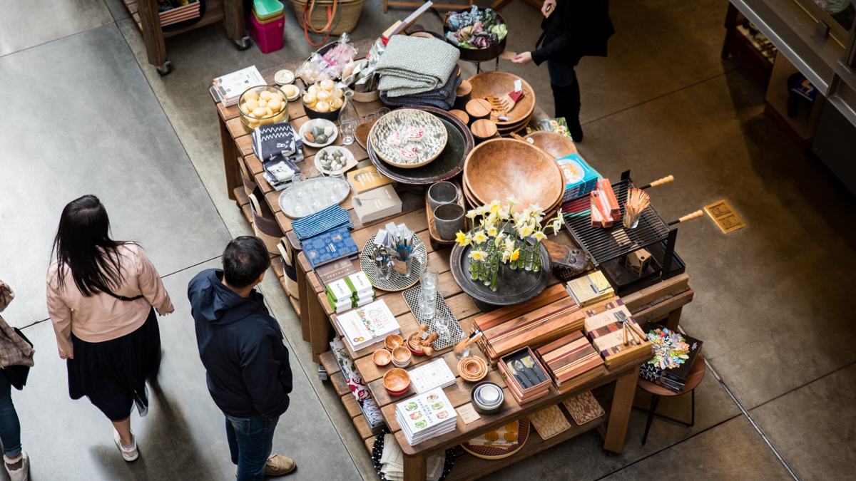
Take a stroll through the Ferry Building’s nave, lined with specialty food shops, offering cheeses, empanadas, ice cream, olive oils and wines, with much more in between.
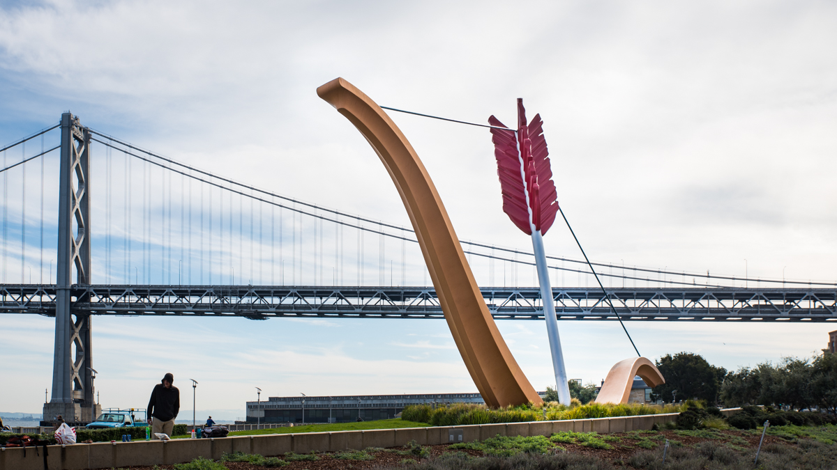
After checking out the shops inside, head through the building to the waterfront out back and take a right into the open plaza. Find the 8-foot tall Mohandas K. Gandhi sculpture of the Indian activist, appropriately greeting you mid-step from his own walk. Continue around to the right, back to the street and take a left down The Embarcadero Promenade. You’ll soon come to another piece of outdoor art, Cupid’s Span, a 60-foot high sculpture of the mythological god’s half-buried bow and arrow – a tribute to San Francisco’s association with love and romance.
Pass under the Bay Bridge and step into Red’s Java House, proudly standing solo on Pier 30 as a tie back to the city’s shipping heydey when longshoremen worked the piers loading and unloading cargo. It first opened as Franco’s Lunch in the 1930s and then redheaded brothers and San Francisco natives, Tom (Red) and Mike McGarvey, bought the place in 1955 and renamed it to Red’s Java House. Contrary to what you’d think from its name, coffee is not the focus here – burgers and dogs are, served on sourdough rolls, no lettuce or tomato. (Open Monday-Friday, 7am to 6pm; Saturday-Sunday, 9am to 6pm; Giants game days, extended hours).
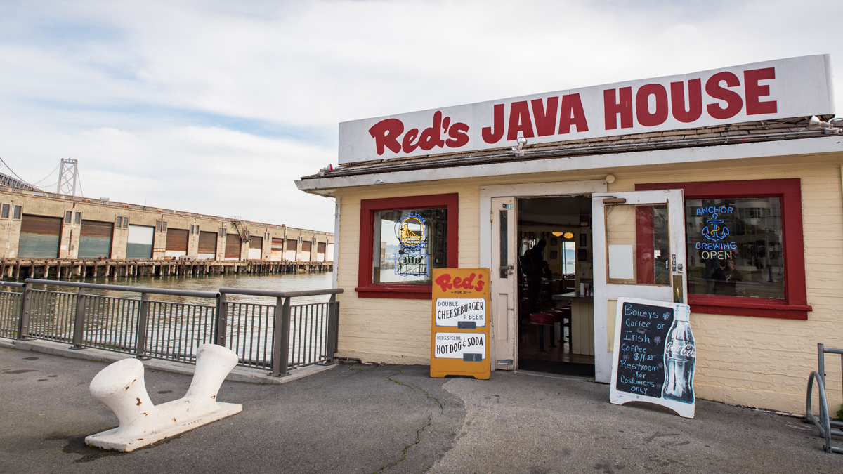
Grab a stool inside at Red’s Java House for your breakfast special (a cheeseburger and a beer) or head out to the back patio and enjoy it with an incredible waterfront view.
Continue along the walkway through the South Beach neighborhood, pass its namesake yacht club and up to Oracle Park. Head around the back to McCovey Cove along Giants Promenade, dotted with plaques highlighting memorable moments in Giants history. On game days, the ferry from Oakland/Alameda docks here and through the stadium arches, fans can catch a few innings for free.
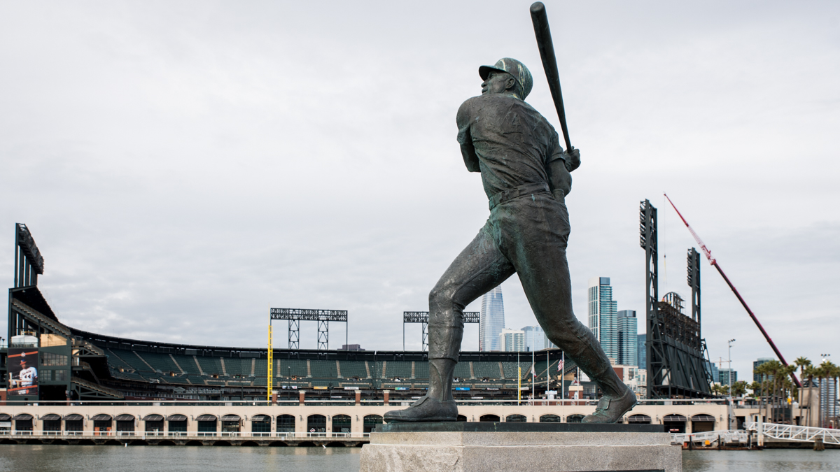
With a fantastic view of Oracle Park across McCovey Cove, Giants fans meet up at China Basin Park for home games to picnic and party.
Back at the street (3rd Street), turn left at the statue of Giants pitching hero Juan Marichal and walk across the Lefty O’Doul Bridge to the rapidly-changing Mission Bay neighborhood. Take steady footsteps on the wooden walkway that shakes slightly from the moving traffic. Also known as the Third Street or China Basin Bridge, it was designed by Joseph Strauss (chief engineer of the Golden Gate Bridge) and, technically speaking, is a “heel trunnion-type bascule” drawbridge. It opened in 1933 and was renamed in 1969 to honor the left-handed baseball legend and San Francisco-born, Francis "Lefty" O'Doul.
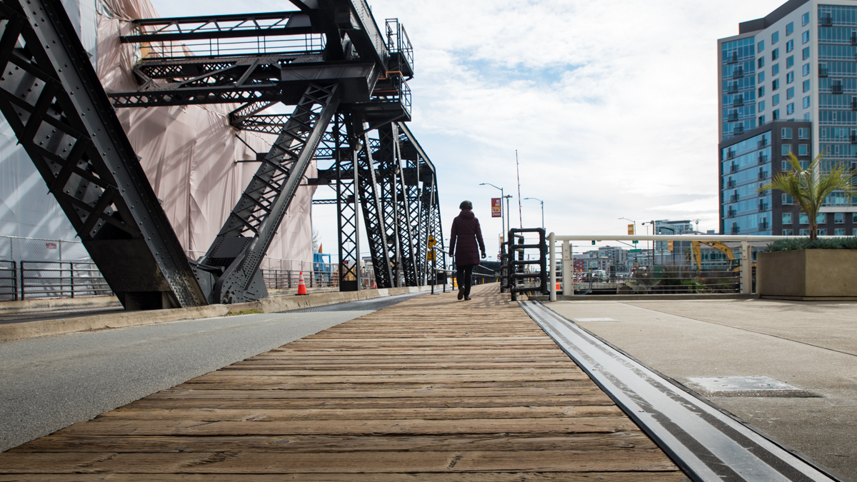
The Lefty O’Doul Bridge is one of four remaining drawbridges in San Francisco. Its massive concrete counterweight lifts and lowers the span in only 3 minutes.
From the other side of the bridge, take another left into China Basin Park, lined with plaques for every Giants team from 1958 to 1999 (when they moved to AT&T Park). Capping the end of the park at the water’s edge is a bronze statue of beloved Willie McCovey in a beautiful swing pose.
Carry on to the right and down Terry A. Francois Boulevard, named after the first African American to sit on the San Francisco Board of Supervisors. At the Bay View Boat Club, veer to the left off the street and onto the San Francisco Bay Trail.
To the right, construction on the Chase Center is at full tilt. The arena is scheduled to be the new home of the Golden State Warriors starting from the 2019-2020 NBA season, and possibly also home to a National Hockey League team in the future.
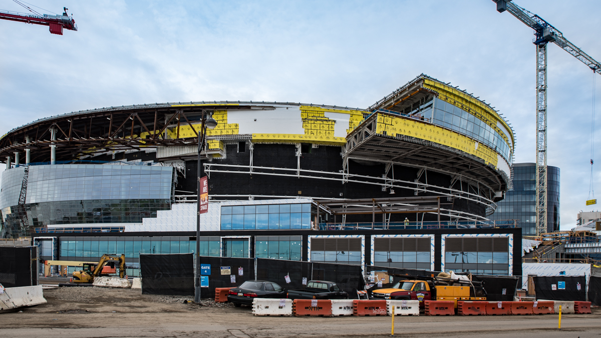
After relocating from Philadelphia in 1962, the Warriors will move here to the Chase Center from the Oracle Arena in Oakland where they’ve played since 1971.
Further along the trail at Mission Rock Resort, Cal fans are delighted by the building’s exterior, clad in old wooden bleachers from Memorial Stadium that were replaced during its renovation in 2012. Owner Peter Osborne, who comes from a family of Berkeley alums, also incorporated the weathered wood into the restaurant’s bar, tables and planter boxes. You can still make out seat numbers stamped into the wood during the stadium's construction in 1923. (Open Monday-Friday, 11am to 9pm; Saturday, 10am to 9pm; Sunday, 10am to 8pm).
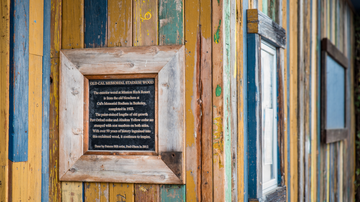
To think that the old Cal Memorial Stadium bleachers used at Mission Rock Resort were almost lost to become cattle fencing in Mexico!
While Mission Rock Resort sports a more contemporary, clean lines feel, its neighbor ahead around the corner, The Ramp, puts forward a funky, gritty waterfront counterpoint. What started out as a bait shop in 1950 has become a go-to spot for burgers and seafood, cocktails and salsa dancing. Though no longer a neighborhood secret, you still see locals enjoying the vibe alongside dock workers, office employees and tourists. (Open Monday-Friday, 11am to 7:30pm; Saturday-Sunday, 10am to 3:30pm; Bar open nightly to 8:30pm).
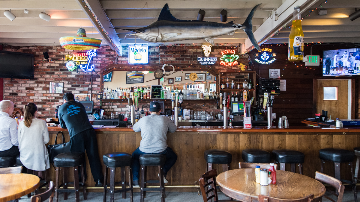
On sunny days, locals and visitors flock to The Ramp for weekend brunch. After the benedicts and Bloody Marys, they stay on for live music and salsa dancing.
Head back out to the street and continue south to the left onto Illinois Street. Turn left at 20th Street into the Union Iron Works Historical District, a 66-acre zone that stretches down to Potrero Point on the bay. Its long history as a major shipbuilding center, starting with Union Iron Works in the 1880s and then the Bethlehem Steel Corporation, makes the district the oldest continuously operating shipyard on the West Coast. The two companies built steel hull warships for the U.S. Navy used in the Spanish-American War and also both world wars. The deteriorating corporate and industrial buildings, built between 1885 and 1941, are being restored and converted into space for offices, artists, retailers and light manufacturing.
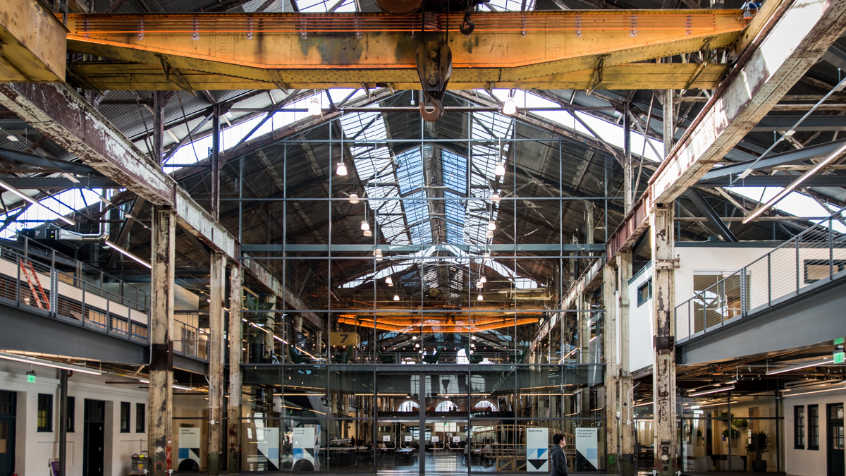
The old Union Iron Works machine shop where ships and submarines were once repaired is now the headquarters of Gusto, a payroll and HR software company.
After a peek at the bones of the old Union Iron Works machine shop from the lobby of Gusto (525 20th St.), double back down 20th Street and cross over 3rd Street, the main commercial area of the Dogpatch neighborhood. Having come through the 1906 earthquake and fire relatively undamaged, Dogpatch has some of the oldest buildings in the city, dating back to the 1860s. Even so, it has been undergoing redevelopment, starting in the 1990s during the dot-com era when rising prices pushed residents out of Potrero Hill and the Mission. As for the origin of its name, there are a few theories floating out there. We’re going with it came from the packs of dogs that scavenged for meat from Butchertown, an old slaughterhouse area nearby in the Bayview district.
Get a few leg stretches in and continue up 20th Street, over the I-280 highway and into Potrero Hill. Blessed with a geographical location that spares it from much fog, Potrero Hill is one of the sunniest neighborhoods in San Francisco. Like Mission Bay and Dogpatch, it also has been transforming over recent decades, moving from a working towards a middle-class, professional demographic. On the cinematic end, Potrero Hill has been in so many movies – the Dirty Harry series, Bullitt, Pacific Heights, The Joy Luck Club, Contagion – that it has an IMDB entry.
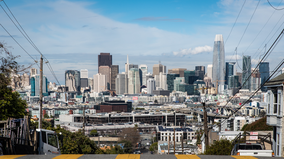
Your reward for hiking up Potrero Hill is “The Streets of San Francisco” views to the north all the way to downtown.
At McKinley Park, where 20th Street hits San Bruno Avenue, take a left onto the dirt trail. But first, for a sweeping view of the Mission and Castro districts up to Twin Peaks, take a short detour into the Potrero Hill Community Garden down to the right. On your way out, check out what residents are growing in their personal plots, which can have waiting lists as long as 10 years!
Back on the dirt trail, head down to Vermont Street and continue down the sidewalk in front of the homes. This section of the street has seven sharp turns that put it in the running for the title of “Crookedest Street in the World,” along with its more famous cousin across town, Lombard Street. Though Vermont Street has one less turn, it’s steeper and has a higher “sinuosity” or crookedness score (1.56 vs. 1.2 for Lombard Street), confirmed by the city’s Department of Public Works on a 2011 episode of the TV show California’s Gold.
At the intersection with 22nd Street, take a right onto the pedestrian bridge over Highway 101 and then turn left onto the continuation of Vermont Street on the backside of San Francisco General Hospital. Take a right onto 24th Street and cross Potrero Street into the Calle 24 Latino Cultural District. Spearheaded by the Calle 24 organization, the district was established in 2014. Covering an area of 12 blocks up to Mission Street, it has the highest concentration of Latino businesses in the city. Specialty coffee shops, new international food restaurants and even a craft beer taproom add to the heady mix. Still, Mexican bakeries, grocery stores, taquerías and other “legacy” businesses, some going back as far as the 1940s, continue to ground the neighborhood.
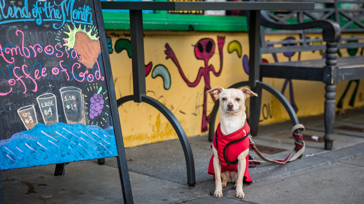
The Calle 24 Latino Cultural District spans 14 city blocks.
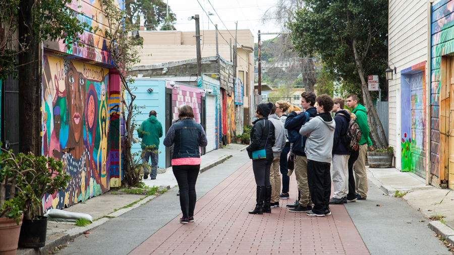
A highlight of walking through the Mission is the spectacular murals on store walls, garage doors and side streets, with the city’s most concentrated grouping along Balmy Alley.
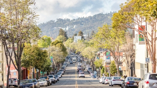
Top off your coffee and take your time heading up the tree-lined street. Pop into an art gallery or one of the handicraft shops on the way to the 24th Street Mission Station at the intersection with Mission Street.
Route Map
Variations and options
- Extend the walk: Continue with the BARTable Walk: 16th Street Mission to Glen Park. Head north towards downtown along Mission Street to the 16th Street Mission Station (a 30-minute walk, or 1 mile away).
- Reverse the route: Start at the 24th Street Mission Station and make it to the Ferry Building in time to look over the fresh farm produce and specialty foods at the Ferry Plaza Farmers Market (Tuesday and Thursday, 10am to 2pm; Saturday, 8am to 2pm).
- Join a walking tour: San Francisco City Guides offers an hour-long Ferry Building Tour on Tuesdays and Saturdays. Free (donations welcome) and the Saturday tour takes place within the farmers’ market hours. Go on an Oracle Park Tour and step out onto the field and sit in the Giants’ team dugout. For a deep dive into the Mission murals, sign up for a Precita Eyes’ Classic Mural Tour.
What to bring: Sturdy walking shoes and a daypack with water, bag lunch or snacks (or pick up along the way), sun protection (hat, sunscreen), extra layers or rain gear (just in case). A smartphone is handy for maps and looking up information or taking photos. And, of course, your Clipper card (or BART ticket)!
About the stations
Embarcadero Station first opened in May 1976. It is the first San Francisco stop for trains crossing the bay from Oakland. With 48,526 average exits each weekday in 2017, it is the busiest station in the BART system, with Montgomery Station close behind. However, the station was not part of the original concept for BART, being built three years after the other San Francisco stations. The redevelopment of the lower Market Street area led to the addition of the station to the system.
24th Street Mission Station first opened in November 1973. Like its twin, 16th Street Mission Station, the two street-level plazas are regularly used as gathering spaces for public meetings and street performances. A renovation of the southwest plaza was completed in 2014. Below ground are the mezzanine level with ticket vending machines and faregates and then an island platform level for the Antioch – SFIA/Millbrae, Dublin/Pleasanton – Daly City, Daly City – Warm Springs/South Fremont and Richmond – Daly City/Millbrae lines.
