BARTable Walk: Fremont to Warm Springs/South Fremont
When:
Enjoy on a nice day
Where:
2000 BART Way
Fremont, CA 94536
United States
BART Station:
FremontWalk Time:
4 hoursTravel all the way to Central Park (there’s one in the Bay Area!) on just a BART fare and visit a California Mission (that’s outside of San Francisco) and its surrounding neighborhoods on this BARTable walk through Fremont.
Walk Time: 4 hours | Distance: 8 miles | Terrain: Level sidewalks and paved trails (with a few residential hills)
Exit the Fremont Station to the west (away from the hills) and through the parking lot. Head down BART Way and take a left onto Civic Center Drive.
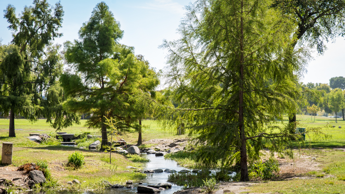
At the intersection with Stevenson Boulevard, cross and take a right to pick up the sidewalk into Central Park. Established in 1960 and bounded by Paseo Padre Parkway, Stevenson Boulevard and a Union Pacific railroad line, the park is located at the heart, both literally and figuratively, of Fremont. It draws residents and visitors to its 450-plus acres of open space to enjoy all sorts of recreational and leisure activities. For sports fans, there are two basketball and 18 tennis courts, six softball and 10 soccer fields as well as a golf course with a driving range. For parents, there are four playground areas to keep the kids busy and for dog lovers, there’s a dog park with two turfed areas for the canine kids to run and socialize. Skaters (board, in-line and roller) have their own pro-designed park with street course and bowls. And there are picnic sites (20-plus, reserved and drop-in) for grill-offs, birthday celebrations and family reunions.
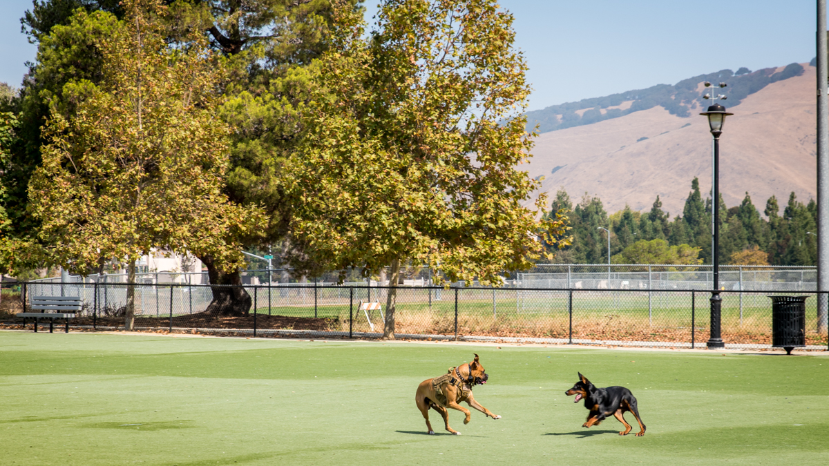
From just about every spot in Fremont’s Central Park is a view of Mission Peak (2,520 feet). Hikers with the strength and stamina to make it to the top are rewarded with views north to Mt. Tamalpais, east to Mt. Diablo (maybe even the Sierras) and south to Mt. Hamilton. Central Park even has a waterpark with pools, slides and an endless river that operates during the summer months.
Keep to the right, past the Fremont Main Library and up a small slope to an informational sign on the park’s Earthquake Walk Tour (see “Variations and options” below for details). Turn left and make your way down the series of parking lots. Connect to the path leading to Lake Elizabeth and take a right onto the lakeside perimeter trail.
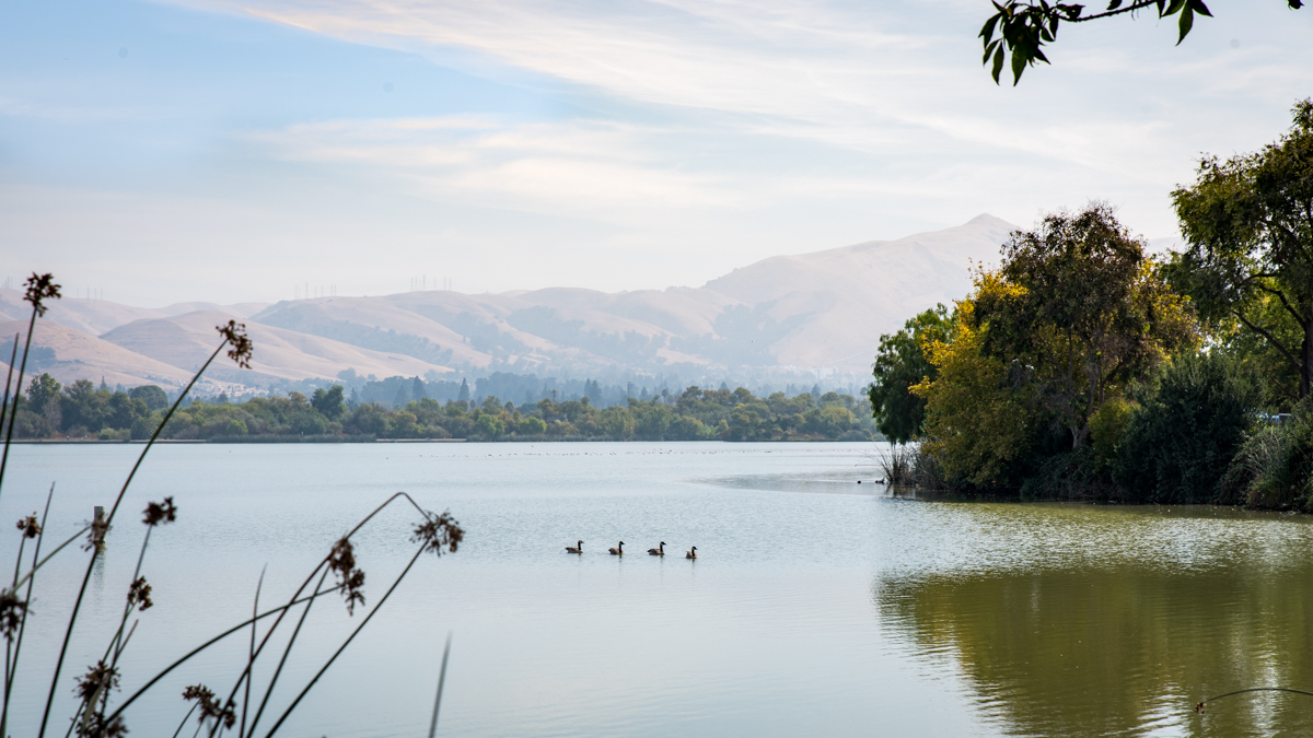
Named after Fremont’s sister city, Elizabeth, Australia, the lake sits at the center of the park and covers 83 acres. The calm, shallow waters are perfect for lower impact activities: fishing, paddle boating and bird-watching. Just get ready to share the space with the armies and ducks and geese!
BART trains run through a pair of tunnels underneath Central Park and Lake Elizabeth on their way to and from the Warm Springs/South Fremont Station.
Continue along the paved path and join the steady parade of walkers, joggers and bikers. If you’re out in the morning, you’ll likely pass folks sitting in meditation or practicing Tai Chi. If it’s a summer evening, you might catch one of the free, weekly concerts at the Performance Pavilion.
After about a mile (30 minutes), the path meets up with the Stivers Lagoon Nature Area. This marshland is home to several types of native trees (cottonwood, oak, willows) and plants (cattail, tule, saltgrass) that attract the birds (sparrows, blackbirds, herons) and also the crawdads, which, in turn, attract the kids who try and catch them.
Keep an eye to the right and veer off the lakeside path to the gated railroad track crossing. Make your way through the first gate, over the tracks and through the second gate to pick the route back up on the Mission Creek Trail.
Carefully look both ways before crossing the tracks of the Union Pacific Railroad line that separates Lake Elizabeth from the park’s golf course.
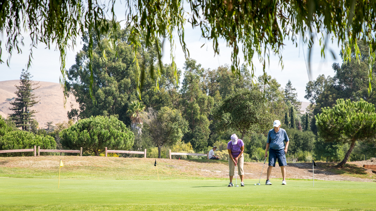
Stay on the trail along the creek, past the golf course, over the metal bridges and through Gomes Park. At Lemos Lane, take a right to Chiltern Drive to safely cross to the other side, head left back up and then right where the trail continues along pine tree-lined Los Pinos Street.
If you wonder what these are that blanket the banks of Mission Creek, they are horsetails (Equisetum arvense). Called a “living fossil,” this group of plants have remained nearly unchanged for millions of years.
At Driscoll Road, again, take a right down to Chiltern Drive to safely cross to the other side, head left back up and then right to continue on this more wooded portion of the trail that passes Mission San Jose Park. Although the Mission Creekwalk informational signs on the creekside are too sun-faded to read, there are two signs in a seating area on the parkside that highlight the area’s history from the Ohlone to the Franciscan missionaries to the early pioneer farmers.
Take a left at Palm Avenue to Mission San Jose High School, founded in 1964 and alma mater of Olympic champ and Bay Area’s own Kristi Yamaguchi.
In their Best High Schools Ranking for 2018, U.S. News & World Report ranked Mission San Jose High School at No. 8 in California and No. 88 in the nation. Well done Warriors!
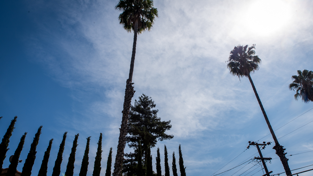
Be sure to look up at the landmark Mexican fan palms (Washingtonia robusta) towering up to 70 feet above their namesake street from Mission Boulevard ahead back down to Mission Creek Drive.
Take a right and head down busy Mission Blvd. At the I-680 underpass, cross over to the left side of the street and continue into the historic district to Mission San José. Founded in 1797 by Franciscan missionaries and built with Native American labor, it is the 14th of 21 outposts of the mission system in (Alta) California, established by the Spanish Empire in its push into the Americas. This mission is one of the five in the Bay Area – the others being Mission Santa Clara de Asís, Mission San Francisco de Asís (aka Dolores), Mission San Rafael Arcángel and Mission San Francisco Solano (Sonoma).
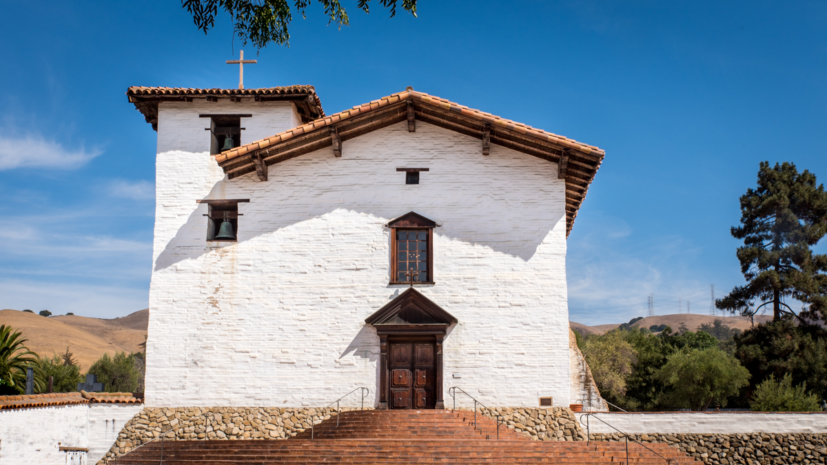
The church of Mission San José is actually a reconstruction completed in 1985. Its predecessor was heavily damaged after an earthquake in 1868, then demolished and replaced with a Gothic-style wooden church (relocated to San Mateo).
Next door to the church is a gift shop through which is access to the inside of the church and the cemetery outside. There is also a museum with informative displays and artifacts covering the peoples, activities, architecture, history of the Mission and more. (Open daily, 10am to 5pm. Admission is $5).
One of the museum rooms focuses on the manufacturing of the adobe bricks (take a look at the recipe!) used to construct the Mission complex, originally comprised of over 100 adobe buildings.
The church, said to be a near-perfect replica of the original, is both ornate with its crystal chandeliers and brightly painted altar and simple with its basic wooden pews and original tile floor.
The gravestone of Robert Livermore (as in Livermore, California) is inside the church, but step outside to the cemetery to see more burial sites of mission pioneers. There is another cemetery for Ohlone tribal members nearby on Washington Boulevard.
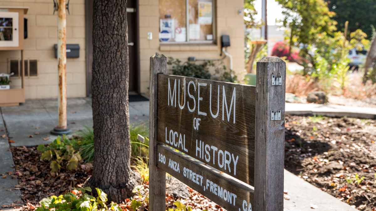
Continue on the route down Mission Boulevard and at the entrance to Ohlone College, cross to the right onto Anza Street and walk a block to the Museum of Local History. Did you know that Fremont had a movie studio in the early 1900s that made silent movies starring Charlie Chaplin? That the first Macintosh computers were made here? Or that camels, saber-tooth tigers and mammoths once roamed the area? Whether you did or not, learn all the details about these fascinating facts and more through the exhibits on display. Tip: Ask if one of the knowledgeable and friendly volunteers can give an orientation to the museum. (Open Wednesday, Friday, every second weekend, 10am to 4pm, free, donations accepted).
The Museum of Local History covers an area originally called Washington Township, a collection of eight small towns that later formed the three cities of Union City (Decoto, Alvarado), Newark and Fremont (Niles, Centerville, Irvington, Mission San Jose, Warm Springs).
The rest of the route (about 3 miles) is through several quiet South Fremont neighborhoods and passes a couple of small parks. Relax, enjoy the rest of the walk and admire the homes (big and small, old and new) along the way.
Take a left from Anza Street at the corner onto Ellsworth Street and take a right onto Pine Street. Cross to the left onto Ibero Way, then take a right onto Camino del Campo and head around Old Mission Park. Take a left onto Paseo Padre Parkway and head down the hill (check out the view across the South Bay towards the Los Altos Hills!), cross Durham Road and take a right onto Parkmeadow Drive. Continue past Arroyo Agua Caliente Park, take a right onto S. Grimmer Boulevard, then a left onto Warm Springs Boulevard to the Warm Springs/South Fremont Station.
Route Maps
From Fremont Station to Central Park
From Central Park to Warm Springs / South Fremont Station
Variations and options
- Take a side trip: Get up close and personal with the Hayward Fault that runs right through Central Park. The geological activity along the fault is a result of movement between the Pacific and North American Plates that creates a build-up of stress, which is released as earthquakes. The Hayward Fault slowly “creeps” (about 5mm a year) causing distinctive cracks seen in the park’s sidewalks, parking lots and buildings. The Math Science Nucleus together with the City of Fremont, U.S. Geological Survey and California Geological Survey put together the Hayward Fault Walk through the park that highlights points of interest with informative “Earthquake Walk Tour” signs.
- Join a walking tour: The Museum of Local History offers walking tours during the spring and summer months at locations throughout the Tri-City Area (Union City, Newark and Fremont), including Mission San José (free, $5 suggested donation). Also, the Mission Peak Heritage Foundation created a self-guided walking tour of the historic Mission San Jose District. Pamphlets are available at the Museum of Local History.
- What to bring: Sturdy walking shoes and a daypack with water, bag lunch or snacks (or pick up along the way), sun protection (hat, sunscreen), extra layers or rain gear (just in case). A smartphone is handy for maps and looking up information or taking photos. And, of course, your Clipper card (or BART ticket)!
About the stations
Fremont Station first opened in September of 1972. It was the terminal station for lines to Daly City and Richmond until the opening of the Warm Springs/South Fremont Station in 2017. Outside the west entrance are two covered bench areas decorated with glass tile mosaics by artist Joe Keivitt and a clock and temperature tower dedicated to George Silliman (1916 – 1997), President of BART’s Board of Directors when operations first began in 1972.
Warm Springs/South Fremont Station first opened in March of 2017. It is currently the most southern station and the first station to open on the BART to Silicon Valley Extension. The station features the largest art installation within the BART system. The rotunda showcases artist Catherine Widgery's "Sky Cycles" that combines images of the sky from different times of day and year and also points of view onto large, semi-translucent glass panels.
