BARTable by bike: Sawyer Camp Trail
BART Station:
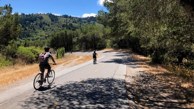
MillbraeA cyclist on the Sawyer Camp Trail with San Andreas Lake in the background. Photo courtesy of BARTable staff.
Difficulty
• Intermediate
Terrain
• A somewhat steep hill to get things started and flat pavement along the trail.
Cautions
• The route includes a couple of short, steep hills. Make sure your gears are in good working order for the ascent and that your brakes are tuned up for the descent.
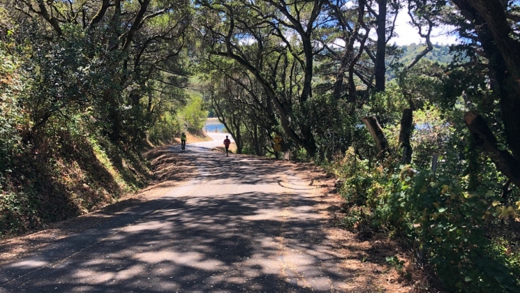
 The Sawyer Camp Trail. Photo courtesy of BARTable staff.
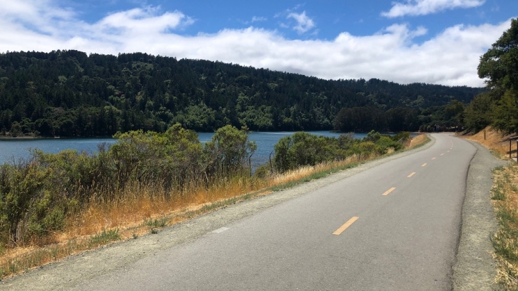 Crystal Springs Reservoir. Photo courtesy of BARTable staff.
Introduction
The Sawyer Camp Trail is a six-mile paved trail that runs through the Peninsula Watershed, west of Millbrae. The trail is quiet, partially wooded and offers great views of the San Andreas Lake and Crystal Springs Reservoir. This is one of the most popular trails in San Mateo County, but that doesn't take away from its serenity. Join us for a ride that starts at Millbrae BART station, climbs up through the Millbrae Highlands and continues along the Sawyer Camp Trail where we'll see several highly scenic habitats, cross directly over the San Andreas Fault, and see a 600-year old tree.
What to bring
Comfortable riding shoes, helmet, water bottles, sun protection (hat, sunscreen), extra layers or rain gear (just in case). A smartphone is handy for maps and looking up information or taking photos. And, of course, your Clipper card. Make sure to download the Ride with GPS app so you can easily reference the route.
 Sawyer Camp Trail. Photo courtesy of BARTable staff.
Map
Route details
From Millbrae station, head west on Linden Ave and turn left on Serra Ave. Cross El Camino Real on Millbrae Ave heading west. After a couple of blocks, cross the road and get on the Millbrae Spur Trail, and ride along this peaceful path under large Eucalyptus trees. At Ashton Ave, get back on Millbrae Ave and continue heading west up into the hills. The climb is fairly steep but the pretty neighborhood makes the exertion more bearable. Once at the top of the hill, follow Skyline Blvd to the right and turn left on Hillcrest Blvd to cross under I-280. Once past the freeway, look for the trailhead on your left. Follow the Sawyer Camp Trail for six miles until you reach its southern end at Crystal Springs Rd. Then, retrace your route back to the Millbrae BART station.
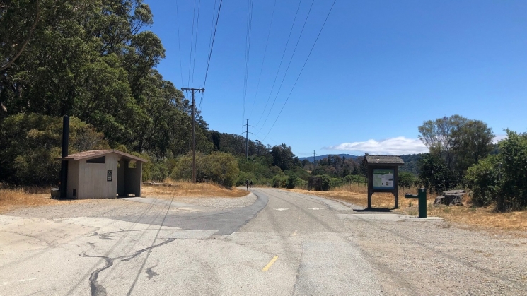 Water and restrooms are available on the trail. Photo courtesy of BARTable staff.
The Sawyer Camp Trail has restrooms near its northern and southern access points and about halfway along its length (2.5 miles from the north end of the segment and 3.5 from the south end of the segment). Picnic areas can also be found at the halfway point and near the parking lot off Crystal Springs Road.
Highlights of the ride
Peninsula Watershed
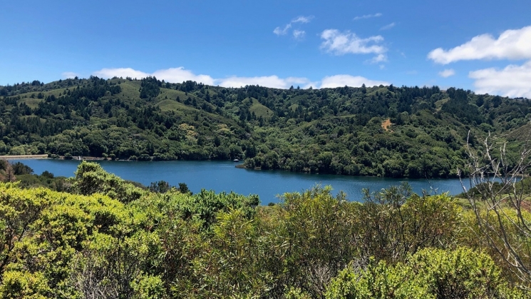
The Sawyer Camp Trail runs through a highly scenic area that features various habitats, from old growth Douglas-fir forests to chaparrals and wetlands. The trail parallels the Coastal Range ridge, the backbone of the Peninsula, and traces the east side of Crystal Springs and San Andreas Reservoirs, which fill the rift along the San Andreas fault line and provide water to San Francisco and the Peninsula.
Over 180 different species of birds have been identified in the area, along with deer, squirrels, bobcats, coyotes and rattlesnakes. Recent sightings of mountain lions have also occurred.
 San Andreas Lake. Photo courtesy of BARTable staff.
San Andreas Lake and Fault
The San Andreas Fault is the largest earthquake fault in North America. While the fault is best known for the earthquakes that periodically shake the region, it’s also home to some of the state’s most beautiful lakes and reservoirs. San Andreas Lake sits directly on the San Andreas Fault. Originally a small pond, the lake was dammed in 1868. In the 1906 San Francisco earthquake, the fault moved nine feet, yet the dam remained intact. Today, the lake is a hub for many recreational activities and is important to the surrounding ecosystem.
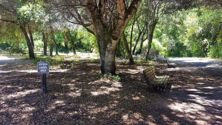 The Jepson Laurel. Photo courtesy of Sawyer Camp Trail.
Jepson Laurel
Midway along the Sawyer Camp Trail you will find the Jepson Laurel, a tree that has been established to be over 600 years old and is now the oldest and largest known Laurel in California. In 1923, this tree was named in honor of Willis Linn Jepson, a noted California botanist. Today, The San Francisco Water Department, on whose property it is located, has assumed the tree's preservation and protection.
Visit bart.gov/bikes to check BART’s bike rules, then strap on your helmet and get out there!