BARTable by bike: Golden Gate Bridge
BART Station:
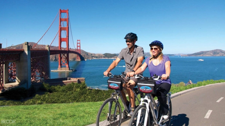
Embarcadero (SF)Riders on the Golden Gate Bridge. Photo courtesy of Peek.
Difficulty
• Intermediate
Terrain
• A mostly flat ride by SF standards, but there are a few hills. About 16-23 miles total.
Cautions
• The route includes a couple of short, steep hills. Make sure your gears are in good working order for the ascent and that your brakes are tuned up for the descent.
• Riding across the Golden Gate Bridge can be intense. If there is strong wind, or fog (as there often is), the experience will be more challenging. Additionally, the bridge always has a lot of foot and bicycle traffic on a path that is narrow, so make sure you are comfortable riding close to other people in tight spaces before attempting to cross.
 The Golden Gate Bridge on a sunny day. Photo courtesy of Klook.
Introduction
From BART's Embarcadero Station to the Golden Gate Bridge, you'll see some of San Francisco's top landmarks: Coit Tower, the Sea Lions of Pier 39, Ghirardelli Square and Aquatic Park, Fort Mason, The Palace of Fine Arts, Fort Point, plus much more. Along the way, you'll pass through the districts of North Beach, Fisherman's Wharf, the Marina, and finally the Presidio. It's a gorgeous ride and easier than you'd think -- the majority of the ride, between the Embarcadero and Fort Point, is almost entirely flat.
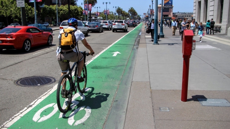 The bike lane along the Embarcadero is painted green to help with visibility. Photo courtesy of Spinlister.
What to bring
Comfortable riding shoes, helmet, water bottles, sun protection (hat, sunscreen), extra layers or rain gear (just in case). A smartphone is handy for maps and looking up information or taking photos. And, of course, your Clipper card. Make sure to download the Ride with GPS app so you can easily reference the route.
Don’t have a bike? No problem! Bike share operator, Bay Wheels offers hybrid electric and classic bikes for rent throughout San Francisco. Just outside Embarcadero Station, there are several docking stations, so you’re bound to find a bike available at any given time.
Tip: If you’re planning on renting from Bay Wheels, make sure you familiarize yourself with its pricing before heading out. Trips are limited to 30-45 minutes depending on the plan, and you don’t want to be surprised with hefty overage charges after your trip. Keep the service map handy for easy reference to nearby docking stations. When coming from Embarcadero, a good spot to exchange your bike for a fresh one is the docking station at Jefferson and Fillmore Streets in the Marina District -- the closest station to the Golden Gate Bridge.
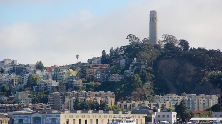 Coit Tower is easy to spot from the Embarcadero. Photo courtesy of ExperienceFirst.
Short route details and highlights along the way
From Embarcadero Station, the ride begins on Market St. Follow Market St northeast until you reach the Ferry Building and the Embarcadero, and turn left onto the green bike lane. Follow The Embarcadero for about 1.5 miles.
On your left, look for Coit Tower on top of Telegraph Hill. On your right, you'll see the Exploratorium. Once you reach Fisherman's Wharf, you’ll hear them before you see them: the world-famous Sea Lions of Pier 39.
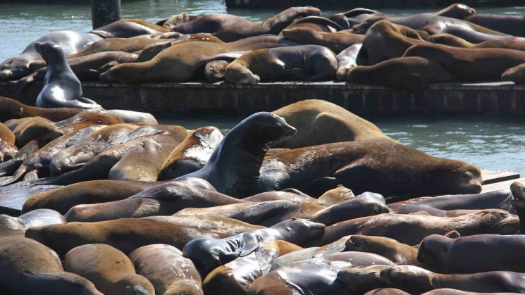 The Sea Lions of Pier 39. Photo courtesy of SF Travel.
Tip: Ride out onto Pier 41 to catch a glimpse of them. Pier 41 offers a good vantage point of the sea lions and is often less crowded than Pier 39.
From Pier 41, get onto Beach St and follow it for a half mile until you reach Ghirardelli Square at Larkin St. Here, stock up on everything-chocolate at The Original Ghirardelli Ice Cream and Chocolate Shop.
Continue on Beach St, cut through Aquatic Park and take a right on Van Ness Ave. Here, you'll tackle the first climb of the day into Fort Mason. It's steep, but don't worry, it's short.
Fort Mason, a former US Army post, covers 1,200 acres. Today, it’s part of the Golden Gate National Recreation Area and home to a mix of attractions. Great Meadow Park is a fantastic place to take in the view of the Golden Gate Bridge, have a picnic, or watch all the dogs running around.
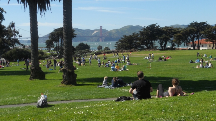 Great Meadow Park at Fort Mason. Photo courtesy of Explore with Tin.
Follow the bike path down the hill, and if needed, grab a coffee and a snack at Equator Coffees -- just off the bike path at Marina Blvd and Laguna St.
Make your way along the waterfront path, part of the San Francisco Bay Trail, into the Marina District. On your right is Marina Green, which was once an airfield for the transcontinental airmail service. The neighborhood itself was built upon rubble from the 1906 San Francisco Earthquake and landfill dredged from the bay for the 1915 Panama-Pacific International Exposition.
At Baker St, make a left and ride a couple of blocks until you reach The Palace of Fine Arts on your right. Conceived to evoke a decaying ruin of ancient Rome, The Palace of Fine Arts became one of San Francisco's most recognizable landmarks.
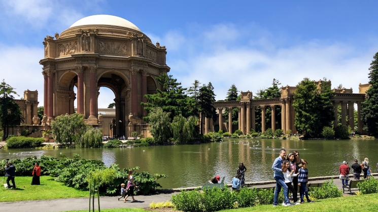 The Palace of Fine Arts. Photo courtesy of Guy Joaquin.
Head back to the bike path and continue west along Mason St. Weave through some parking areas and along Marine Dr to reach Fort Point. This National Historic Site defended the Bay following California's Gold Rush through World War II. Today, If the conditions are right, you'll be able to see some surfers defending the point.
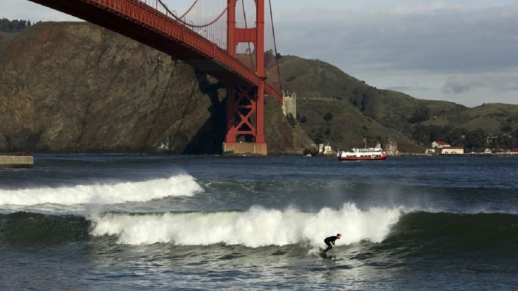 A surfer at Fort Point. Photo courtesy of Bloomberg.
Now, it's time to take on the biggest climb of the day, up to the bridge itself. Backtrack a bit from Fort Point and turn right on Long Ave to begin the climb. At the intersection with Lincoln Blvd, you'll see the Battery E bike path. Turn right and follow the trail until it reaches the bridge.
Depending on the season and time of day, you'll either be riding across the bridge on the east sidewalk or the west sidewalk. Make sure to familiarize yourself with the rules of the bridge before heading across.
Long route details
The long route follows the same path as the short route but adds about seven miles to the total round-trip distance by making a stop in Sausalito. Head to Sausalito for an abundance of shops and dining opportunities, scenic views, and charming houseboat enclaves. To get there, from the bridge, you'll descend about 200 feet, so keep in mind you'll be climbing back up on your way out.
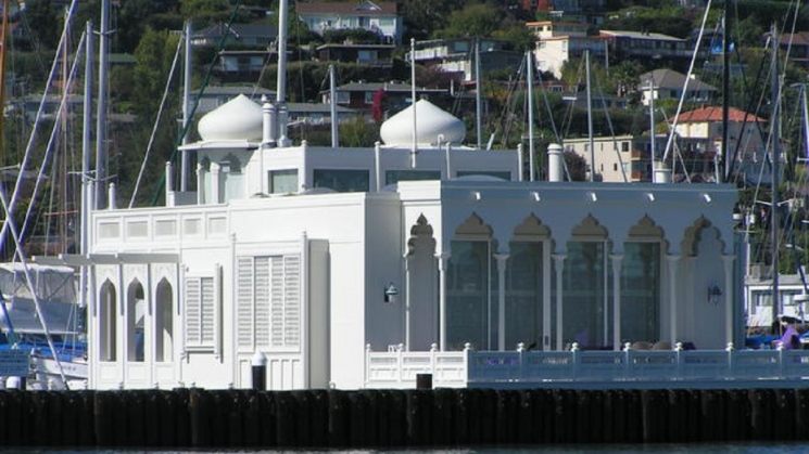 The Taj Mahal houseboat in Sausalito. Photo courtesy of CBS News.
Maps
When you're ready to bid the bridge adieu, hop back on your bike and set off towards that other bridge -- the Bay Bridge, which unfortunately does not yet have a bike path across its entire length. Want to support a bike path on the Bay Bridge from Oakland to San Francisco? Show your support for a shared-use path.
Visit bart.gov/bikes to check BART’s bike rules, then strap on your helmet and get out there!