BARTable Walk: Walnut Creek to Pleasant Hill/Contra Costa Centre
When:
Enjoy on a nice day
Where:
200 Ygnacio Valley Rd.
Walnut Creek, CA 94596
United States
BART Station:
Walnut CreekWalk Time:
1.5 to 2 hoursDo you love to shop, dine, watch a show or enjoy art or the outdoors? Yes to any or all of the above? Then this BARTable walk though the heart of downtown Walnut Creek to Pleasant Hill has something for you.
Walk Time: 1.5 to 2 hours | Distance: 3.3 miles | Terrain: Level sidewalks and paved trails
Begin your walk by exiting the Walnut Creek station, passing the bus stops opposite the parking garage. Cross the intersection of N. California Boulevard and Ygnacio Valley Road to the back of the Target store. Walk to the right down N. California Boulevard along the back of the store, take a left at Lacassie Avenue and then a right on to Locust Street.
If you start out on a Sunday morning, you’ll pass right through the Walnut Creek Farmers’ Market. Open year-round (9am to 1pm), the market not only offers fresh, locally-farmed produce, but also many artisan-made products from breads and cheeses to specialty meats and condiments. There are also prepared foods that you can eat there (or take away) while enjoying performances from local musicians and artists.
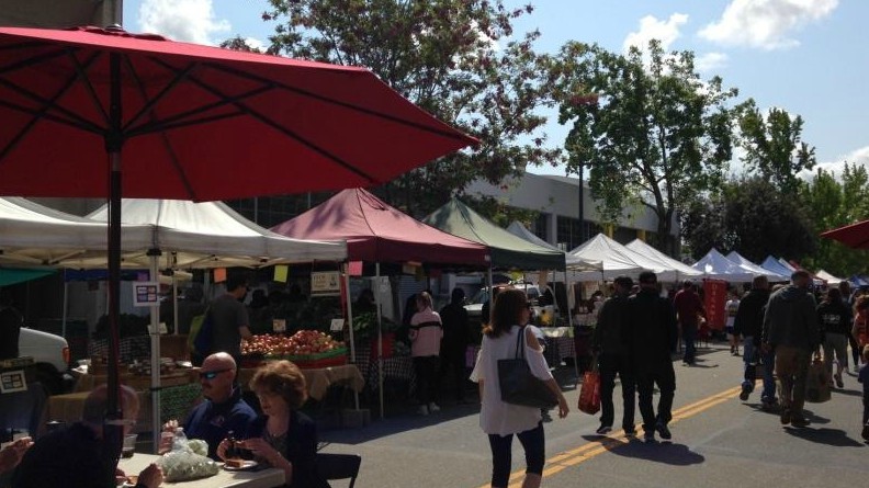
There’s more to the Walnut Creek Farmers’ Market than just fruits and veggies. Local crafts, info booths — even knife sharpening!
At the intersection with Civic Drive is the Lesher Center for the Arts, named after Dean Lesher, Bay Area philanthropist and founder of the Contra Costa Times. Opened in 1990, the center is a regional venue for guest speakers and live theater entertainment, including ballet, symphony and musical performances.
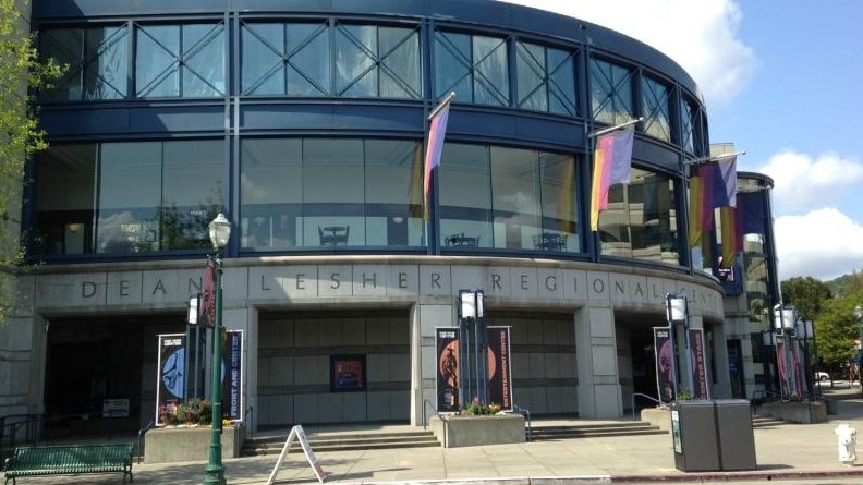
Lesher Center for the Arts also houses the Bedford Gallery that focuses on visual arts and oversees the city’s public art program.
Continue down Locust Street to enter the hub of Walnut Creek’s hopping bar and restaurant scene. With just too many to highlight here, you can probably find a different place to eat and drink every day of the month. Take your pick. Italian? Japanese? BBQ? Vegetarian? How about Spanish tapas to share or just a scoop (or two) of ice cream? They’re all here, and more.
Take a left on to Mt. Diablo Boulevard and cross over N. Main Street to the corner in front of the Pottery Barn store. From here, you can take a short side trip to the right down Mt. Diablo Boulevard to the Liberty Bell Plaza for a breather at the fountain. The site marks the location where Las Trampas Creek and San Ramon Creek join to form “The” Walnut Creek.
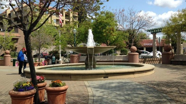
Contrasting pavers and fountain tiles at the Liberty Bell Plaza represent three major creeks of Walnut Creek.
Tucked off to the side is the reason for the plaza’s name — a replica of the Liberty Bell that President Gerald Ford dedicated as a war memorial on a visit to Walnut Creek during the U.S. Bicentennial (1976).
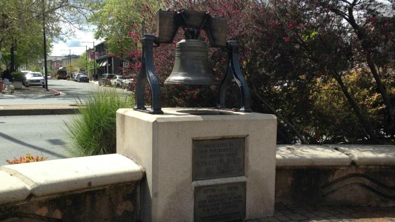
During its dedication, President Ford accidentally broke the hanging clapper of the Liberty Bell Replica.
For a long side trip, you can cross Mt. Diablo Boulevard over to Broadway Plaza. Anchored by upscale department stores, this open-air shopping center has 80-plus stores and restaurants, drawing shoppers from throughout the Bay Area and beyond.
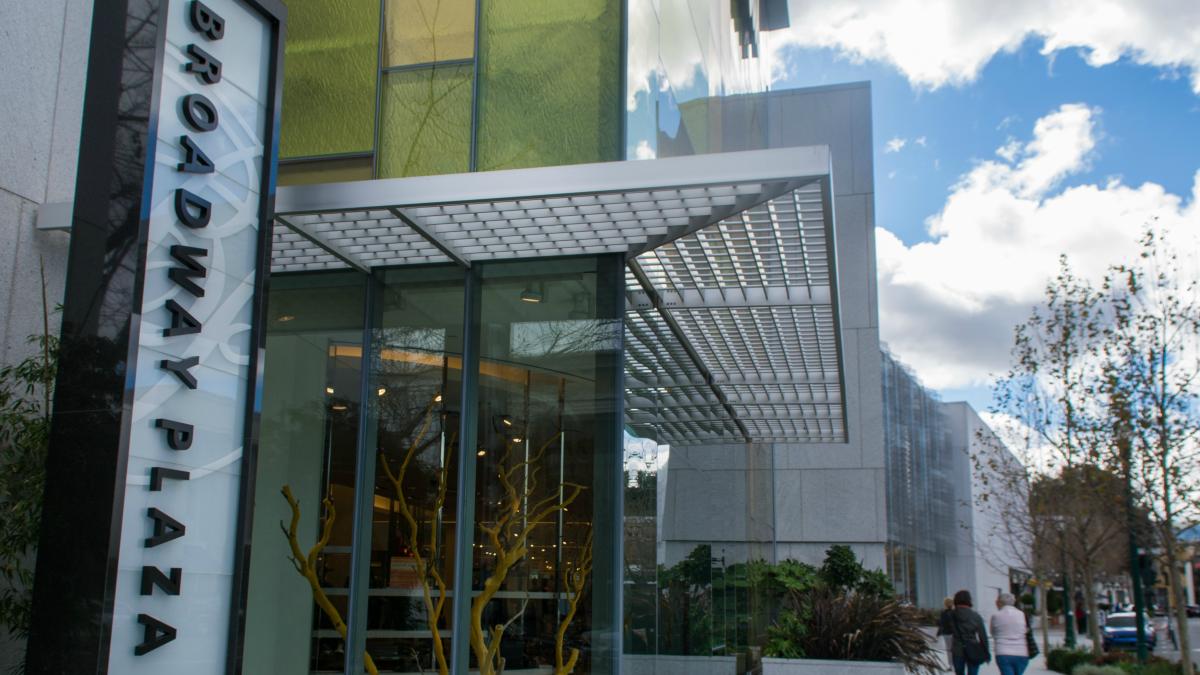
Having undergone several renovations, Broadway Plaza has come a long way since its opening in 1951 with just 38 stores.
To continue the walk, return to the corner in front of Pottery Barn. Face the store, then turn left and meander down N. Main Street. Lined with shady trees and historic sites, take your time and maybe check out a few of the stores now or on a return trip.
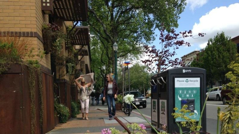
Amid the growth and changes downtown, Main Street has kept much of its small(er) town charm.
Take a right at Lincoln Avenue and cross N. Broadway to the Walnut Creek Library. Head down either side of the building to Civic Park, where the city’s community center and art studios are located. Prominently positioned in the park is the Hand of Peace sculpture by Italian-born artist and peace activist, Beniamino Bufano. Standing over 30 feet, the sculpture was created in 1967 and is made of copper sheets, concrete, stained glass and almost 1,000 pounds of mosaic tiles. Legend is that Bufano cut off his trigger (index) finger and mailed it to President Woodrow Wilson as a protest against World War I.
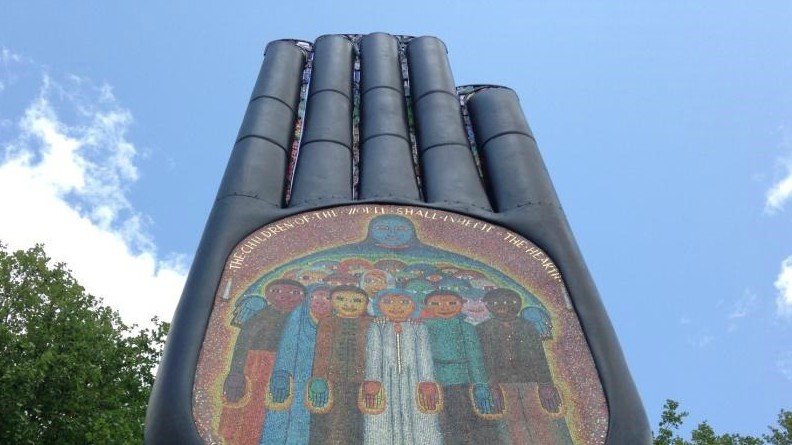
The inscription above the palm in the Hand of Peace sculpture has a typo. Can you spot it?
From the sculpture, weave your way past the Civic Center gazebo and children’s playground, through the parking lot, and to the right across the bridge over Walnut Creek.
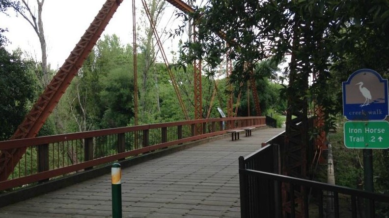
This metal bridge is the first of four to cross on the way to the Pleasant Hill station.
Keep left along the Creek Walk (the picnic tables and benches are nice spots for lunch or a break) and take another left to join the runners, bikers and strollers on the Iron Horse Regional Trail. This popular, multi-use trail runs between Concord and Pleasanton for 32 miles, following the Southern Pacific Railroad right-of-way.
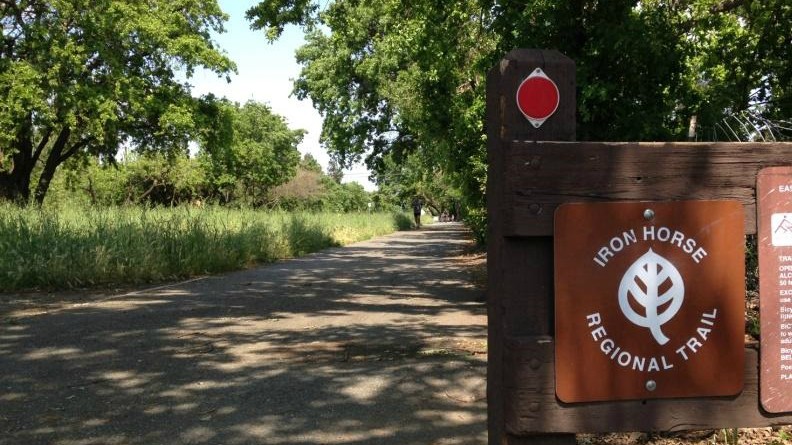
On the Iron Horse Regional Trail, you might catch a disc golf tournament in progress as you pass Walden Park.
Walk this final stretch (1.7 miles) on the trail straight through to the Pleasant Hill station, crossing the bridges over Ygnacio Valley Road and Treat Boulevard.
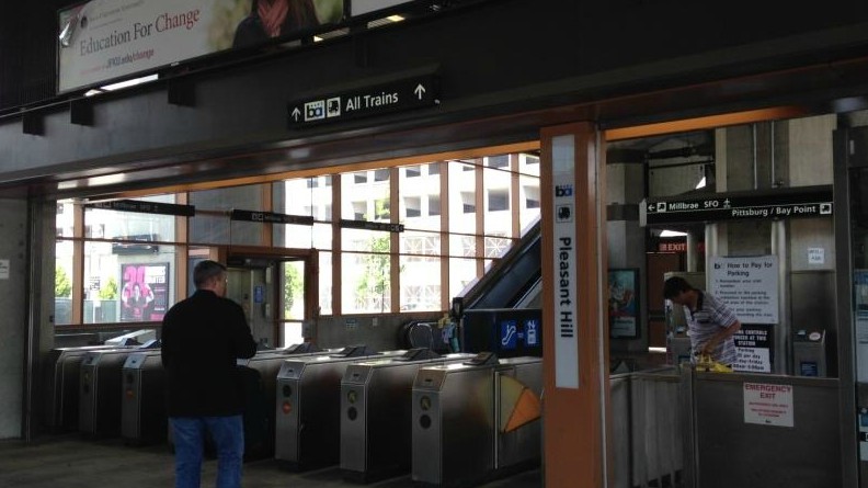
Once through the faregates and up on the platform of the Pleasant Hill station, don’t miss the views of Mt. Diablo.
Route Map
Variations and options
- Extend the walk: For you history buffs, add all or parts of the self-guided Downtown Heritage Walk that features 60 historic sites and points of interest, such as the Liberty Bell Replica. If you’re more of an art aficionado, there’s also a self-guided tour for public art that highlights 33 works, including the Hand of Peace sculpture. Each stop is marked with an information sign post and instructions on how to listen to an audio description on your cellphone. And with a smartphone, you can access a mobile app. For maps and details, visit Walk Walnut Creek.
- Walk the route in reverse: Start from the Pleasant Hill station and catch a movie or show, shop, or grab a bite to eat in downtown Walnut Creek (there are many places to dine al fresco), and then head home from the Walnut Creek station.
What to bring
Sturdy walking shoes and a daypack with water, bag lunch or snacks (or pick up along the way), sun protection (hat, sunscreen), extra layers or rain gear (just in case). A smartphone is handy for maps and looking up information, or taking photos. And, of course, your BART ticket or Clipper card.
About the stations
Walnut Creek Station first opened in May of 1973 as part of an extension project from MacArthur to Concord. In terms of total weekday exits, it is one of Contra Costa County’s busiest BART stations, along with Pleasant Hill and El Cerrito del Norte stations. The station consists of two levels — a bottom concourse with ticket vending machines and faregates, and an elevated platform for the Pittsburg/Baypoint and SFO/Millbrae lines.
Pleasant Hill/Contra Costa Centre Station also opened in May of 1973 and has a similar layout to the Walnut Creek station and the same train lines. Located at the north end of Walnut Creek and the eastern edge of Pleasant Hill, the station sits in Contra Costa Centre. This transit-oriented district is a mix of business offices, stores and restaurants, and also housing, some built on parts of an old BART parking lot.