BARTable Walk: Dublin/Pleasanton to West Dublin/Pleasanton
When:
Enjoy on a nice day
Where:
5801 Owens Dr.
Pleasanton, CA 94588
United States
BART Station:
Dublin/PleasantonWalk Time:
4 hoursGet on your riding leathers and check out a motorcycle museum, then strap on your boots for a hike up to a spectacular vista point before jumping back in time to the pioneer days of the 1800s on this BARTable walk through Dublin.
Walk Time: 4 hours | Distance: 8 miles | Terrain: Sidewalks, paved and dirt hiking trails (with moderate climbs and descents)
The Route
Exit the Dublin/Pleasanton station to the street. If you need to pick up provisions or grab a bite first, take a detour across the street, turn left and continue to the right along Iron Horse Parkway. Take a right on to Martinelli Way to the Persimmon Place shopping center where there is a Whole Foods Market and several restaurants (add 30 minutes, 1 mile round-trip). There is also a Safeway along the featured route on Dublin Boulevard (45 minutes, 1.5 miles away).
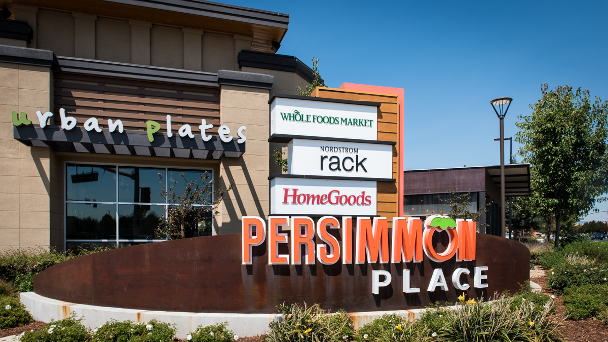
Persimmon Place has a Whole Foods and several restaurants if you need to fuel up before taking the walk.
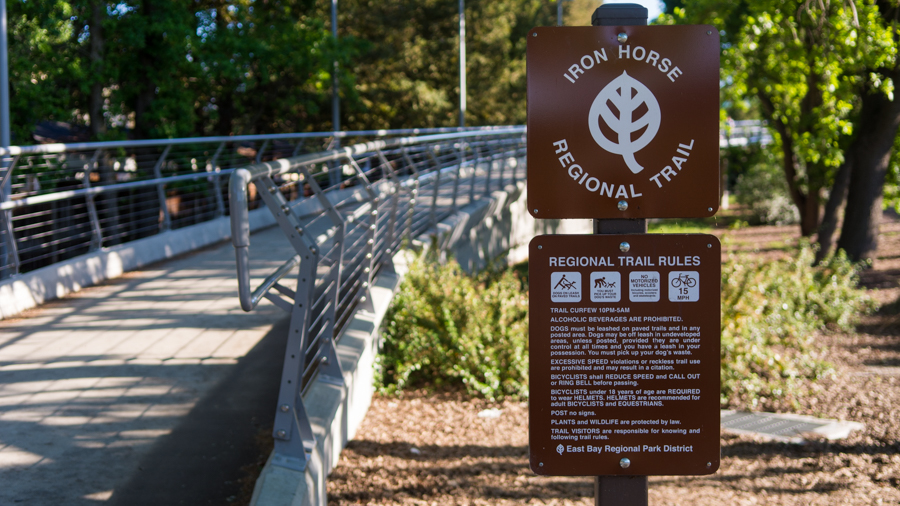
Otherwise, from the station entrance/exit, take a left and walk along the sidewalk, past the bus stop plaza, to the Iron Horse Regional Trail. Technically, you’re already on the trail. From its northernmost point in Concord near Highway 4, it winds 32 miles south through Pleasant Hill, Walnut Creek, Alamo, Danville, San Ramon and then into Dublin, through the station to Pleasanton where it currently ends at Santa Rita Road. The plan is to expand it farther up to Suisun Bay and out to Livermore for a total of 55 miles. The trail follows and gets its name from a Southern Pacific Railroad right-of-way, established for its San Ramon Valley Branch line in the late 1800s and then abandoned in the 1970s. Not only is the trail a popular recreational resource for walkers, bikers and even equestrians up and down the corridor, it’s also part of the daily commute route for many local residents and workers.
There was talk in 2003 for a BART line from the Walnut Creek station along the Iron Horse Corridor and out to Tracy using diesel cars, like those running on the BART to Antioch line.
At the intersection with Dublin Boulevard, take a left to the showroom of Arlen Ness Motorcycles (closed Sundays, free). If you’re into bikes, Arlen Ness needs no introduction. A legend in the motorcycling community with the awards and accolades to prove it, he’s well-known for his custom motorcycles sporting amazing body and paint designs. Ness moved with his family from Minnesota to San Leandro in the sixth grade and with the winnings from semi-pro bowling tournaments, he bought his first motorcycle, a Harley-Davidson. He customized it and the rest, as they say, is history. After building bikes out of his garage in San Leandro, Ness moved to a spot on East 14th Street in the early 1970s and then headed inland in 2003 to Dublin, running the business as family affair with his son and grandson.
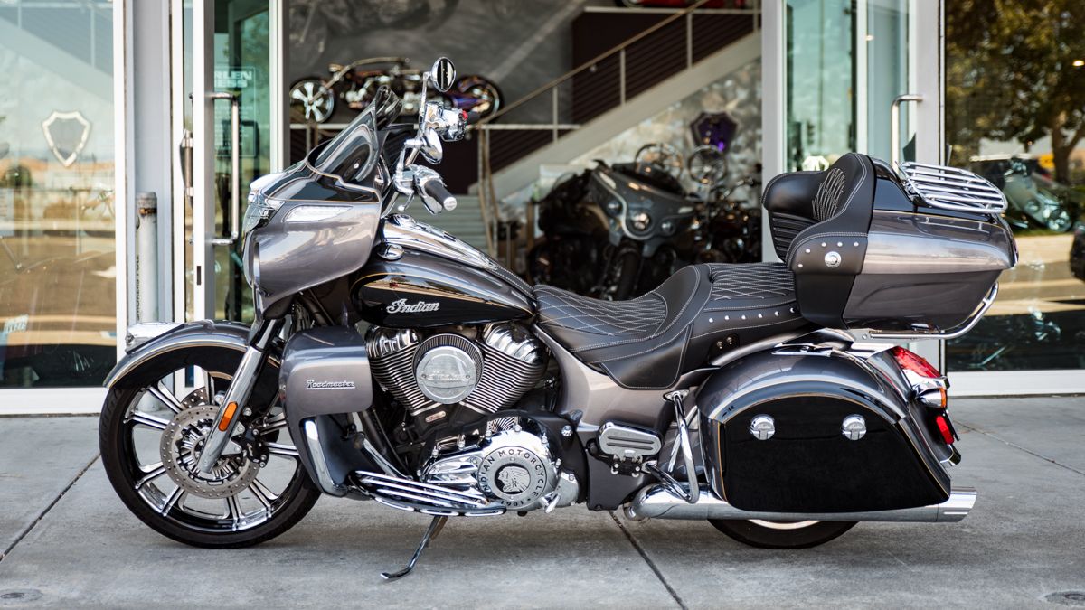
Head upstairs to the museum at Arlen Ness Motorcycles and see over 40 of Ness’ custom bikes in styles ranging from vintage-inspired to smooth Euro sports car to classic American cruiser.
Head back out to Dublin Boulevard and continue to the left. As there is no crosswalk on the left side of the street at Dougherty Road, cross to the right first then make your way around the intersection to the opposite side. At the Dublin Sports Grounds, veer off the street and connect to the trail that runs alongside the parking lot. This 22-acre park features lighted sports fields (baseball, soccer and softball) as well as picnic areas with barbeque grills and children’s playgrounds – a good spot for a lunch or pitstop (restrooms and water are available).
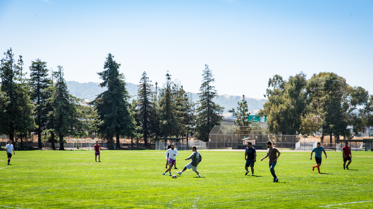
Maybe catch an inning of a little league baseball game or a soccer shoot-out at the expansive Dublin Sports Grounds.
The trail drops you off at Dublin’s Civic Plaza, punctuated with a 68-foot tall clock tower. Back to the left is the modern, light-filled Dublin Public Library and on the right is the Civic Center building, home to the city’s administrative offices and police services. Cross the street and head right along the walkway past the Civic Center fountain and take a left back on to Dublin Boulevard. At Village Parkway, cross over and continue down the right side of the street.
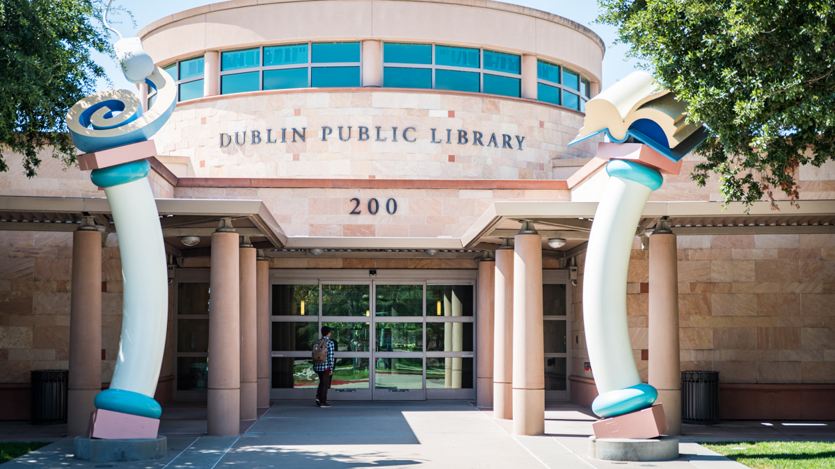
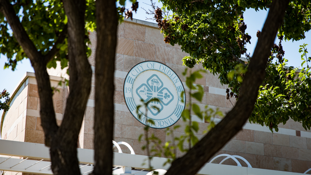
Top, Dublin Public Library. Bottom, the City of Dublin Civic Center.
As you walk under the I-680 highway, take a look at the Dublin Historic Crossroads Murals on both sides of the underpass. Each mural is 16-by-200 feet and honors the city’s history and position as a crossroads of the Bay Area – today, for being at the intersection of I-580 and I-680 highways and further back over 200 years when it was the crossroads of two stagecoach routes, from the bay out to Stockton and from Martinez down to San Jose.
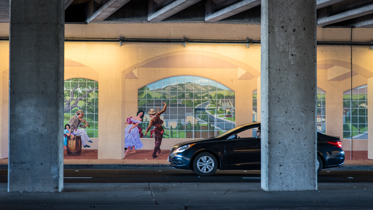
Designed and painted by several artists in 2003, another set of the Dublin Historic Crossroads Murals is on an underpass to the north where I-680 crosses Amador Valley Boulevard.
Keep walking along Dublin Boulevard, using the next several blocks to warm up for the upcoming hike. Check your water and provision levels. Safeway is on the right if you need to top off. No restrooms or water are available along the trail. If you’re not feeling up for the 2.5-mile trail hike or if it’s too warm, save it for a return visit. See “Variations and options” below for details.
Take a right on to Silvergate Drive and cross to the left side of the street at Hansen Drive. At Bay Laurel Street, walk across the small lawn to the Martin Canyon Creek Trail on the left.
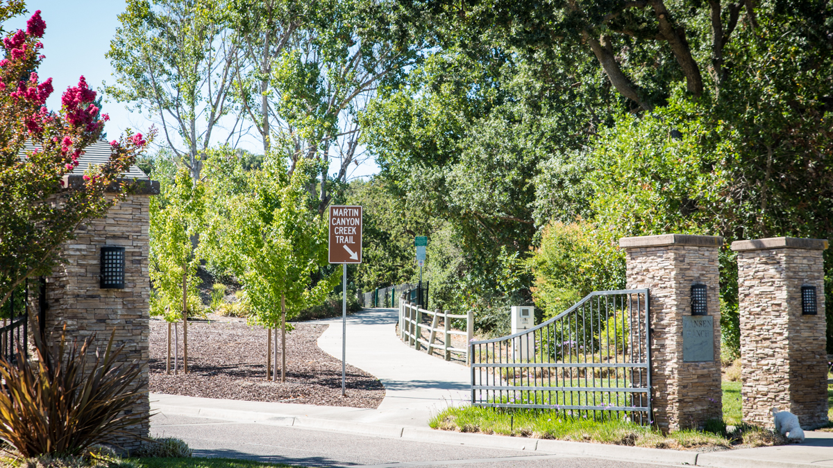
The Martin Canyon Creek Trail begins just inside the stone gates of the Hansen Ranch neighborhood.
Billed by Dublin as one of its “little-known treasures,” the Martin Canyon Creek Trail is wellmaintained and a local favorite for hikers, runners, families and dogs (and their humans). It winds through the canyon alongside the creek for about a mile and a half. The shady oaks and bay laurels that line the trail are a welcome contrast to the wide open skies in the city. There are a few side trails that lead down to the creek. Stick to the main trail as it crosses the creek over several bridges and stay to the right as it passes Dry Creek Road. Be on the lookout for hawks soaring above, lizards bathing in the sun and cattle grazing in the canyon valley ahead.
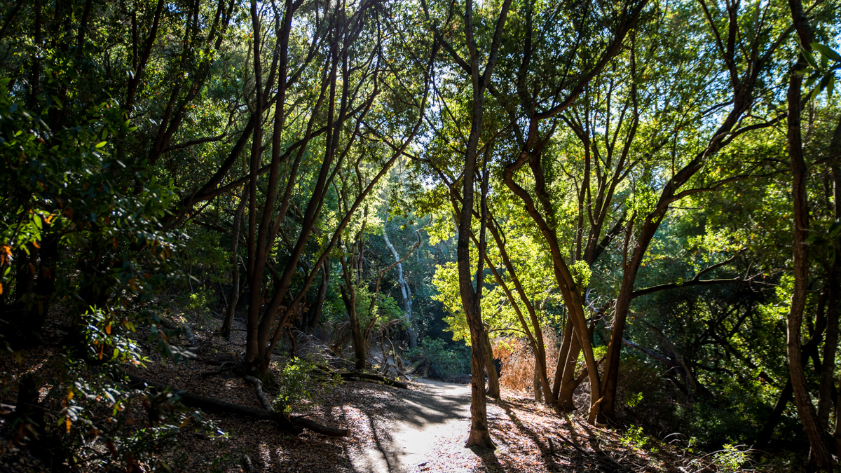
Alert! Poison oak is widespread along the trail. Learn to identify it. It grows in different forms and colors. Skin contact can cause an allergic reaction. “Leaves of three, let it be.”
The trail passes through a gate, which marks the end of the city-maintained portion and the entrance to the Dublin Hills Regional Park, part of the East Bay Regional Parks District. Some areas in the 654-acre park have remained untouched by human hands since the 1800s. From this point, the trail conditions change – the path narrows, gets steeper and in place of grasses and shrubs are ferns, vines and mosses.
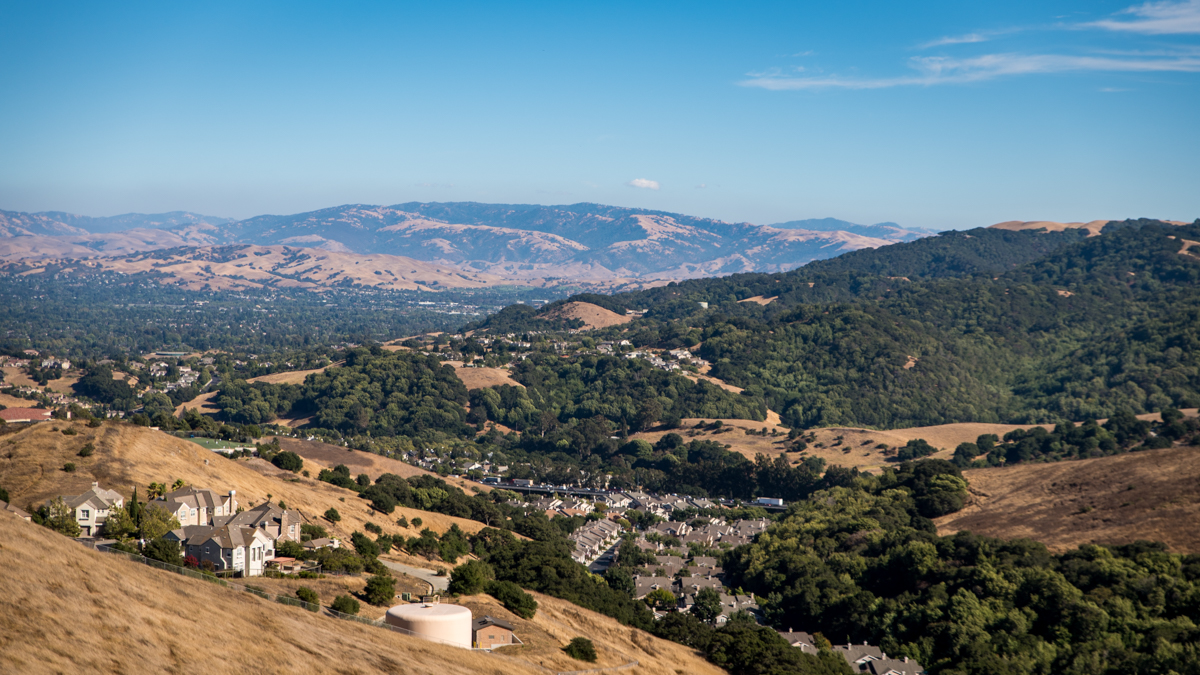
Keep at it! At the hilltop, the trail emerges from the woodlands and connects to the Donlon Loop Trail. Stay to the left and walk out to the ridge for your well-deserved reward: a panoramic view of the Tri-Valley area, from San Ramon south to Pleasanton and out east to Livermore.
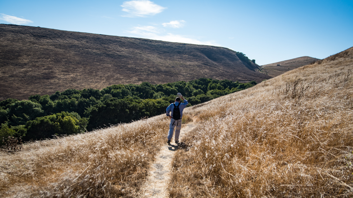
At the top of the Donlon Loop Trail, depending on the day’s weather, enjoy either a cool breeze coming in from the bay or a warm Delta wind blowing in from the east.
After catching your breath and drinking some water, follow the trail down through the grasses to the trailhead at Brigadoon Way. Walk down the street through the California Highlands neighborhood to Dublin Boulevard and take a left to head back into town.
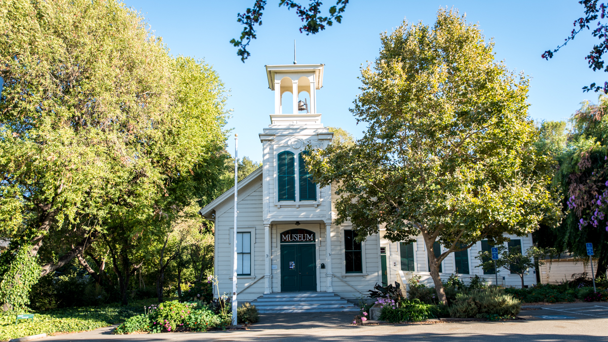
The Dublin Heritage Park & Museums are open Wednesday, Thursday, Saturday and Sunday from 1 to 4pm. Admission is free.
At Donlon Way, cross over to the Dublin Heritage Park & Museums (open Wednesday, Thursday, Saturday and Sunday: 1 to 4 pm, free) and take a deep dive into the history of the city’s pioneers who settled here in the 1800s. The 10-acre park has a wide open lawn with picnic tables (restrooms, water available) and a collection of original buildings from the time period. Here’s a rundown of the highlights.
The Murray Schoolhouse was built in 1856 and is one of the earliest schools in eastern Alameda County. It now houses a museum that presents the history of Dublin through the journey of three teenagers who traveled from Ireland to California in 1836 and eventually settled in the area now called Dublin, after the city from their homeland. The museum also includes exhibits on Dublin’s ranching days and its native Californian history.
The Murray Schoolhouse is a bit of a rolling stone having been moved twice – first from Flanagan Lane to Dublin Canyon Road and then to its current location to save it from city growth and the widening of I-580.
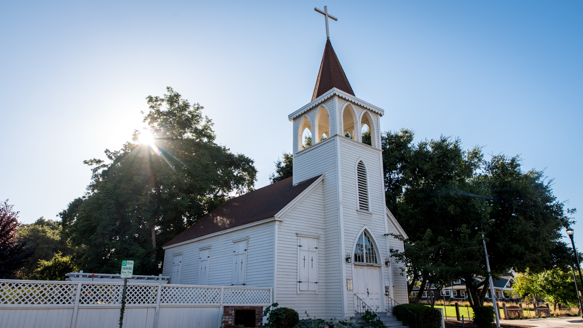
Old St. Raymond's Church was placed on the National Register of Historic Places on April 12, 2006.
The Old St. Raymond’s Church was built in 1859 and is the oldest existing Catholic church in Alameda County. It started out as a mission church since the community could not initially afford a resident priest so a member of the Oakland clergy would ride out on mule or horseback to lead services.
The Old St. Raymond’s Church (there’s a new one off of San Ramon Road) was built in the Gothic Revival style with wood from the Oakland hills. The belfry was added in 1880. The church’s simple design showcases its gleaming original redwood plank floors that make it a beautiful venue for weddings and private events.
The Kolb House is a craftsman-style bungalow built by George Kolb in 1911. Born in Bavaria in 1866, Kolb immigrated to the U.S. and settled in Dublin in 1880. He started a family farm on 300 acres in 1900 that ran for more than 100 years. The house was acquired from the Kolb Family Trust in 2008 along with other buildings from the family’s old ranch and all moved to the park from their original location in Pleasanton. The Kolb House, now a museum, is set up with original family furnishings and personal items that give a fascinating window back in time to the family’s life during the last century. The kitchen transports you back to the 1950s when it was renovated with pastel colors, laminate counters and sleek appliances. Upstairs is the children’s bedroom with dresses and dolls of the Kolb sisters, Donna and Carol, on display.
Here’s a tip: Check if a staff member from the Dublin History Museum is available to give a guided tour of the buildings. (They can also open the doors, if locked.)
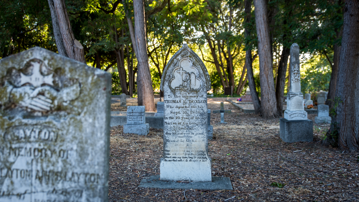
Dublin Pioneer Cemetery is a "who's who" of the city's pioneering citizens.
The last highlighted site is the Dublin Pioneer Cemetery, adjacent to the Old Murray Schoolhouse. Wander among the tombstones that read as a “who’s who” of the city’s pioneering citizens. Some have signs with interesting extra details, such as the Harlan family who left Missouri in 1846 as part of the ill-fated Donner Party, but split off in Utah and made it through to California. The first and probably most famous burial is that of Tom Donlon who fell to his death during the construction of the Old St. Raymond’s Church.
Names on tombstones in the Dublin Pioneer Cemetery are echoed throughout the city in the names of streets, parks, schools and neighborhoods: Donlon, Dougherty, Green, Fallon, Murray and Wells among them.
To finish the walk, return along Donlon Way to Dublin Boulevard and take a right. As there is no crosswalk on the right side of the street at San Ramon Road, cross to the left first then make your way around the intersection to the opposite side. Continue for two blocks and take a right on to Golden Gate Drive to the West Dublin/Pleasanton station at the end of the street.
Route Map
Variations and options
- Shorten the walk: Save the hike portion for a return visit. After crossing San Ramon Road on Dublin Boulevard, cross to the left at Donlon Way to the Dublin Heritage Park & Museums and continue the walk as described above (subtract 2.5 hours, 4.5 miles).
- Extend the walk: Walk the route in reverse and catch a movie or do some shopping. At the end, cross the street in front of the station entrance/exit, turn left and continue to the right along Iron Horse Parkway. Take a right on to Martinelli Way and continue past the Persimmon Place shopping center to the Hacienda Crossings shopping center where there are several restaurants, big name stores and an IMAX movie theater (add 1 hour, 2 miles round-trip).
- What to bring: Sturdy walking shoes (hiking shoes recommended if including the hike) and a daypack with water (extra for the hike), bag lunch or snacks (or pick up along the way), sun protection (hat, sunscreen), extra layers or rain gear (just in case). A smartphone is handy for maps and looking up information or taking photos. And, of course, your BART ticket or Clipper card!
About the stations
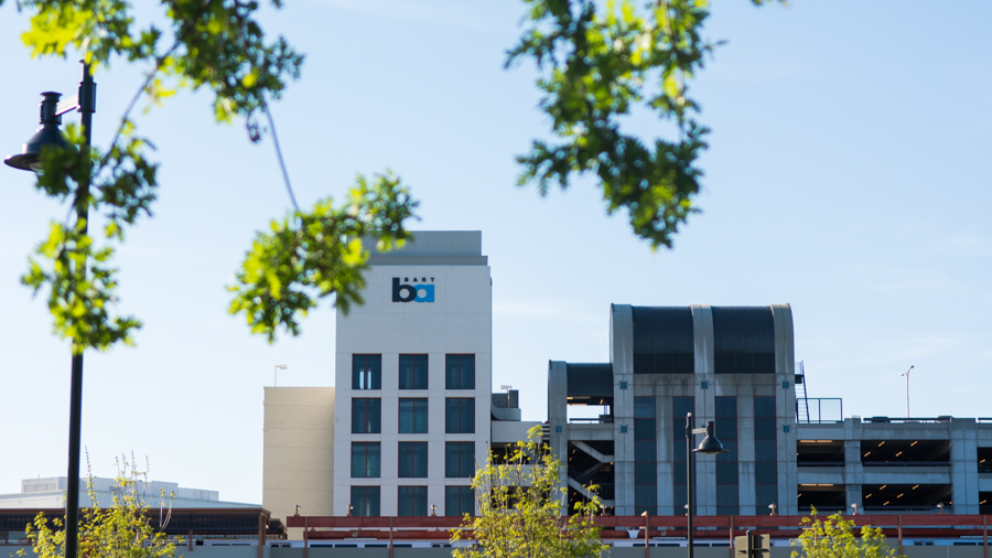
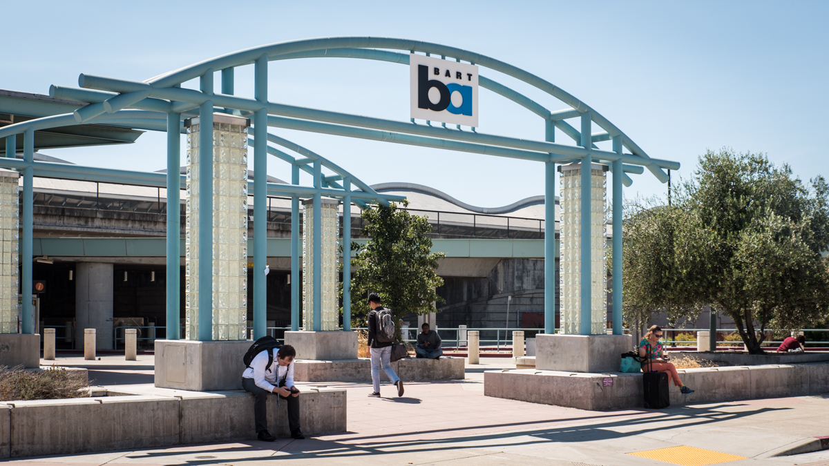
Dublin/Pleasanton Station first opened in May of 1997. It is the eastern terminal station for the line to Daly City that joins/breaks from the other lines at the Bay Fair station. A distinctive feature of the station is the wave motif used throughout its design – most visibly in the metal canopy roof over the island platform. The five curves represent the nearby rolling hills and also the sound waves created by BART’s electric propulsion system.
West Dublin/Pleasanton Station first opened in February of 2011. It is the 44th station in the system and features an island platform for the Dublin/Pleasanton – Daly City line. It is an infill station built between the Dublin/Pleasanton and Castro Valley stations. Like the Dublin/Pleasanton station, it is situated along the medium of the I-580 highway, straddling the border of the two cities.

by Felicia Kieselhorst